|
|
|
Advertisements:
TransportationAirports World Ranking: 211
1 (2012)
Airports - with paved runways
Total 1
2,438 to 3,047 m 1 (2012) Roadways World Ranking: 196
Total 447 km
Paved 447 km Note Public roads - 225 km; private roads - 222 km (2007) Merchant marine World Ranking: 41
Total 139
By type Bulk carrier 22, chemical tanker 3, container 14, liquefied gas 43, passenger 27, passenger/cargo 2, petroleum tanker 19, refrigerated cargo 9 Foreign-owned 105 (France 1, Germany 14, Greece 8, Hong Kong 4, Ireland 1, Israel 3, Japan 2, Monaco 2, Nigeria 11, Norway 5, Sweden 14, UK 14, US 26) Registered in other countries 241 (Bahamas 15, Cyprus 1, France 5, Greece 3, Hong Kong 20, Isle of Man 7, Liberia 4, Malta 15, Marshall Islands 35, Netherlands 1, Norway 24, Panama 27, Philippines 47, Saint Vincent and the Grenadines 1, Singapore 25, UK 6, US 5) (2010) Ports and terminals
Hamilton, Ireland Island, Saint George
Comments
Add a new comment: |
Advertisement
Members area
Bermuda [ United Kingdom ] (Overseas Territory):
 
GPS points from Bermuda [ United Kingdom ] (Overseas Territory)
|
||||||||

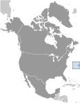 Bermuda was first settled in 1609 by shipwrecked English colonists headed for Virginia. Tourism to the island to escape North American winters first developed in Victorian times. Tourism continues to be important to the island's economy, although international business has overtaken it in recent years. Bermuda has also developed into a highly successful offshore financial center. A referendum on independence from the UK was soundly defeated in 1995.