|
|
|
Advertisements:
GeographyLocation
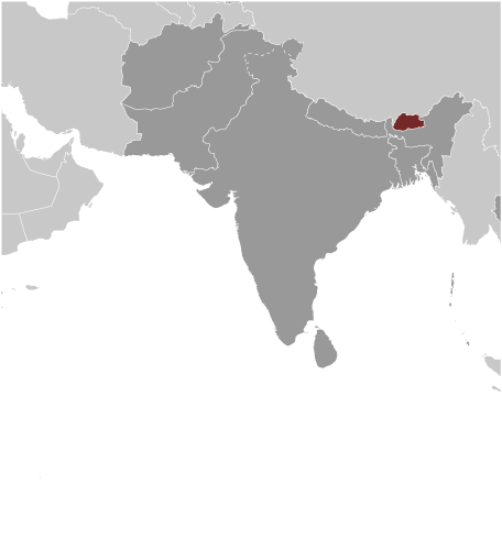
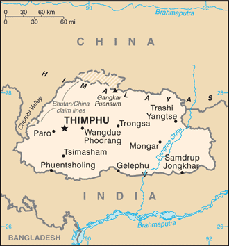
Southern Asia, between China and India Geographic coordinates
27 30 N, 90 30 E
Map references
Asia
Area World Ranking: 137
Total 38,394 sq km
Land 38,394 sq km Water 0 sq km Area - comparative
About one-half the size of Indiana Land boundaries
Total 1,075 km
Border countries China 470 km, India 605 km Coastline
0 km (landlocked)
Maritime claims
None (landlocked)
Climate
Varies; tropical in southern plains; cool winters and hot summers in central valleys; severe winters and cool summers in Himalayas Terrain
Mostly mountainous with some fertile valleys and savanna Elevation extremes
Lowest point Drangeme Chhu 97 m
Highest point Gangkar Puensum 7,570 m Natural resources
Timber, hydropower, gypsum, calcium carbonate Land use
Arable land 2.3%
Permanent crops 0.43% Other 97.27% (2005) Irrigated land
400 sq km (2003)
Total renewable water resources
95 cu km (1987)
Freshwater withdrawal (domestic/industrial/agricultural)
Total 0.43 cu km/yr (5%/1%/94%)
Per capita 199 cu m/yr (2000) Natural hazards
Violent storms from the Himalayas are the source of the country's name, which translates as Land of the Thunder Dragon; frequent landslides during the rainy season Environment - current issues
Soil erosion; limited access to potable water Environment - international agreements
Party to
Biodiversity, Climate Change, Climate Change-Kyoto Protocol, Desertification, Endangered Species, Hazardous Wastes, Ozone Layer Protection Signed, but not ratified Law of the SeaGeography - note
Landlocked; strategic location between China and India; controls several key Himalayan mountain passes
Comments
Add a new comment: |
Advertisement
Members area
Bhutan (Thimphu):
GPS points from Bhutan (Thimphu)
|
||||||||
 In 1865, Britain and Bhutan signed the Treaty of Sinchulu, under which Bhutan would receive an annual subsidy in exchange for ceding some border land to British India. Under British influence, a monarchy was set up in 1907; three years later, a treaty was signed whereby the British agreed not to interfere in Bhutanese internal affairs and Bhutan allowed Britain to direct its foreign affairs. This role was assumed by independent India after 1947. Two years later, a formal Indo-Bhutanese accord returned the areas of Bhutan annexed by the British, formalized the annual subsidies the country received, and defined India's responsibilities in defense and foreign relations. A refugee issue of over 100,000 Bhutanese in Nepal remains unresolved; 90% of the refugees are housed in seven United Nations Office of the High Commissioner for Refugees (UNHCR) camps. In March 2005, King Jigme Singye WANGCHUCK unveiled the government's draft constitution - which would introduce major democratic reforms - and pledged to hold a national referendum for its approval. In December 2006, the King abdicated the throne to his son, Jigme Khesar Namgyel WANGCHUCK, in order to give him experience as head of state before the democratic transition. In early 2007, India and Bhutan renegotiated their treaty to allow Bhutan greater autonomy in conducting its foreign policy, although Thimphu continues to coordinate policy decisions in this area with New Delhi. In July 2007, seven ministers of Bhutan's 10-member cabinet resigned to join the political process, and the cabinet acted as a caretaker regime until democratic elections for seats to the country's first parliament were completed in March 2008. The king ratified the country's first constitution in July 2008.