|
|
|
Advertisements:
GeographyLocation
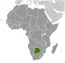
Southern Africa, north of South Africa Geographic coordinates
22 00 S, 24 00 E
Map references
Africa
Area World Ranking: 48
Total 581,730 sq km
Land 566,730 sq km Water 15,000 sq km Area - comparative
Slightly smaller than Texas
Land boundaries
Total 4,013 km
Border countries Namibia 1,360 km, South Africa 1,840 km, Zimbabwe 813 km Coastline
0 km (landlocked)
Maritime claims
None (landlocked)
Climate
Semiarid; warm winters and hot summers Terrain
Predominantly flat to gently rolling tableland; Kalahari Desert in southwest Elevation extremes
Lowest point
Junction of the Limpopo and Shashe Rivers 513 m Highest point Tsodilo Hills 1,489 mNatural resources
Diamonds, copper, nickel, salt, soda ash, potash, coal, iron ore, silver Land use
Arable land 0.65%
Permanent crops 0.01% Other 99.34% (2005) Irrigated land
20 sq km (2003)
Total renewable water resources
14.7 cu km (2001)
Freshwater withdrawal (domestic/industrial/agricultural)
Total 0.19 cu km/yr (41%/18%/41%)
Per capita 107 cu m/yr (2000) Natural hazards
Periodic droughts; seasonal August winds blow from the west, carrying sand and dust across the country, which can obscure visibility Environment - current issues
Overgrazing; desertification; limited freshwater resources Environment - international agreements
Party to
Biodiversity, Climate Change, Climate Change-Kyoto Protocol, Desertification, Endangered Species, Hazardous Wastes, Law of the Sea, Ozone Layer Protection, Wetlands Signed, but not ratified None of the selected agreements Geography - note
Landlocked; population concentrated in eastern part of the country
Comments
Add a new comment: |
Advertisement
Members area
Botswana (Gaborone):
 
GPS points from Botswana (Gaborone)
|
||||||||

 Formerly the British protectorate of Bechuanaland, Botswana adopted its new name upon independence in 1966. Four decades of uninterrupted civilian leadership, progressive social policies, and significant capital investment have created one of the most dynamic economies in Africa. Mineral extraction, principally diamond mining, dominates economic activity, though tourism is a growing sector due to the country's conservation practices and extensive nature preserves. Botswana has one of the world's highest known rates of HIV/AIDS infection, but also one of Africa's most progressive and comprehensive programs for dealing with the disease.