|
|
|
Advertisements:
GeographyLocation
Eastern South America, bordering the Atlantic Ocean Geographic coordinates
10 00 S, 55 00 W
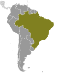
Map references
South America
Area World Ranking: 5
Total 8,514,877 sq km
Land 8,459,417 sq km Water 55,460 sq km Note Includes Arquipelago de Fernando de Noronha, Atol das Rocas, Ilha da Trindade, Ilhas Martin Vaz, and Penedos de Sao Pedro e Sao Paulo Area - comparative
Slightly smaller than the US
Land boundaries
Total 16,885 km
Border countries Argentina 1,261 km, Bolivia 3,423 km, Colombia 1,644 km, French Guiana 730 km, Guyana 1,606 km, Paraguay 1,365 km, Peru 2,995 km, Suriname 593 km, Uruguay 1,068 km, Venezuela 2,200 km Coastline
7,491 km
Maritime claims
Territorial sea 12 nm
Contiguous zone 24 nm Exclusive economic zone 200 nm Continental shelf 200 nm or to edge of the continental margin Climate
Mostly tropical, but temperate in south Terrain
Mostly flat to rolling lowlands in north; some plains, hills, mountains, and narrow coastal belt Elevation extremes
Lowest point Atlantic Ocean 0 m
Highest point Pico da Neblina 2,994 m Natural resources
Bauxite, gold, iron ore, manganese, nickel, phosphates, platinum, tin, rare earth elements, uranium, petroleum, hydropower, timber Land use
Arable land 6.93%
Permanent crops 0.89% Other 92.18% (2005) Irrigated land
45,000 sq km (2003)
Total renewable water resources
8,233 cu km (2000)
Freshwater withdrawal (domestic/industrial/agricultural)
Total 59.3 cu km/yr (20%/18%/62%)
Per capita 318 cu m/yr (2000) Natural hazards
Recurring droughts in northeast; floods and occasional frost in south Environment - current issues
Deforestation in Amazon Basin destroys the habitat and endangers a multitude of plant and animal species indigenous to the area; there is a lucrative illegal wildlife trade; air and water pollution in Rio de Janeiro, Sao Paulo, and several other large cities; land degradation and water pollution caused by improper mining activities; wetland degradation; severe oil spills Environment - international agreements
Party to
Antarctic-Environmental Protocol, Antarctic-Marine Living Resources, Antarctic Seals, Antarctic Treaty, Biodiversity, Climate Change, Climate Change-Kyoto Protocol, Desertification, Endangered Species, Environmental Modification, Hazardous Wastes, Law of the Sea, Marine Dumping, Ozone Layer Protection, Ship Pollution, Tropical Timber 83, Tropical Timber 94, Wetlands, Whaling Signed, but not ratified None of the selected agreements Geography - note
Largest country in South America; shares common boundaries with every South American country except Chile and Ecuador
Comments
Add a new comment: |
Advertisement
Members area
Brazil (Brasilia):
 
GPS points from Brazil (Brasilia)
|
||||||||

 Following more than three centuries under Portuguese rule, Brazil gained its independence in 1822, maintaining a monarchical system of government until the abolition of slavery in 1888 and the subsequent proclamation of a republic by the military in 1889. Brazilian coffee exporters politically dominated the country until populist leader Getulio VARGAS rose to power in 1930. By far the largest and most populous country in South America, Brazil underwent more than a half century of populist and military government until 1985, when the military regime peacefully ceded power to civilian rulers. Brazil continues to pursue industrial and agricultural growth and development of its interior. Exploiting vast natural resources and a large labor pool, it is today South America's leading economic power and a regional leader, one of the first in the area to begin an economic recovery. Highly unequal income distribution and crime remain pressing problems.