|
|
|
Advertisements:
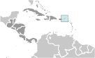
GeographyLocation
Caribbean, between the Caribbean Sea and the North Atlantic Ocean, east of Puerto Rico Geographic coordinates
18 30 N, 64 30 W
Map references
Central America and the Caribbean
Area World Ranking: 219
Total 151 sq km
Land 151 sq km Water 0 sq km Note Comprised of 16 inhabited and more than 20 uninhabited islands; includes the islands of Tortola, Anegada, Virgin Gorda, Jost van Dyke Area - comparative
About 0.9 times the size of Washington, DC Land boundaries
0 km
Coastline
80 km
Maritime claims
Territorial sea 3 nm
Exclusive fishing zone 200 nm Climate
Subtropical; humid; temperatures moderated by trade winds Terrain
Coral islands relatively flat; volcanic islands steep, hilly Elevation extremes
Lowest point Caribbean Sea 0 m
Highest point Mount Sage 521 m Natural resources
NEGL
Land use
Arable land 20%
Permanent crops 6.67% Other 73.33% (2005) Irrigated land
NA
Natural hazards
Hurricanes and tropical storms (July to October) Environment - current issues
Limited natural freshwater resources except for a few seasonal streams and springs on Tortola; most of the islands' water supply comes from wells and rainwater catchments Geography - note
Strong ties to nearby US Virgin Islands and Puerto Rico
Comments
Add a new comment: |
Advertisement
Members area
British Virgin Islands [ United Kingdom ] (Overseas Territory):
 
GPS points from British Virgin Islands [ United Kingdom ] (Overseas Territory)
|
||||||||

 First inhabited by Arawak and later by Carib Indians, the Virgin Islands were settled by the Dutch in 1648 and then annexed by the English in 1672. The islands were part of the British colony of the Leeward Islands from 1872-1960; they were granted autonomy in 1967. The economy is closely tied to the larger and more populous US Virgin Islands to the west; the US dollar is the legal currency.