|
|
|
Advertisements:
TransportationAirports World Ranking: 213
1 (2012)
Airports - with paved runways
Total 1
Over 3,047 m 1 (2012) Heliports
3 (2012)
Pipelines
Condensate 33 km; gas 37 km; oil 18 km (2010) Roadways World Ranking: 167
Total 2,971 km
Paved 2,411 km Unpaved 560 km (2008) Waterways World Ranking: 97
209 km (navigable by craft drawing less than 1.2 m; the Belait, Brunei, and Tutong rivers are major transport links) (2012) Merchant marine World Ranking: 115
Total 9
By type Chemical tanker 1, liquefied gas 8 Foreign-owned 2 (UK 2) (2010)Ports and terminals
Lumut, Muara, Seria
Comments
Add a new comment: |
Advertisement
Members area
Brunei (Bandar Seri Begawan):
 
GPS points from Brunei (Bandar Seri Begawan)
|
||||||||

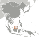 The Sultanate of Brunei's influence peaked between the 15th and 17th centuries when its control extended over coastal areas of northwest Borneo and the southern Philippines. Brunei subsequently entered a period of decline brought on by internal strife over royal succession, colonial expansion of European powers, and piracy. In 1888, Brunei became a British protectorate; independence was achieved in 1984. The same family has ruled Brunei for over six centuries. Brunei benefits from extensive petroleum and natural gas fields, the source of one of the highest per capita GDPs in Asia.