|
|
|
Advertisements:
GeographyLocation
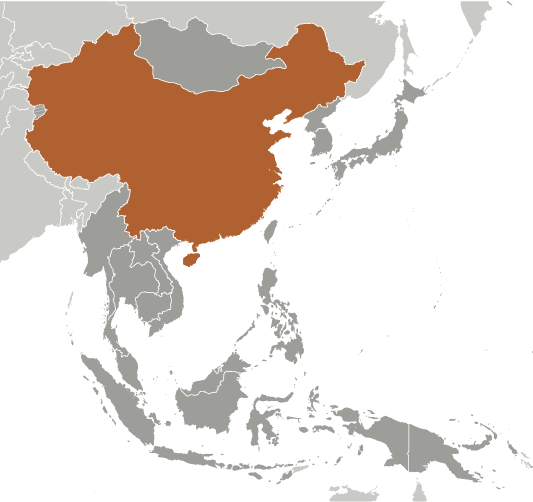
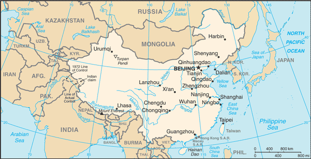
Eastern Asia, bordering the East China Sea, Korea Bay, Yellow Sea, and South China Sea, between North Korea and Vietnam Geographic coordinates
35 00 N, 105 00 E
Map references
Asia
Area World Ranking: 4
Total 9,596,961 sq km
Land 9,569,901 sq km Water 27,060 sq km Area - comparative
Slightly smaller than the US
Land boundaries
Total 22,117 km
Border countries Afghanistan 76 km, Bhutan 470 km, Burma 2,185 km, India 3,380 km, Kazakhstan 1,533 km, North Korea 1,416 km, Kyrgyzstan 858 km, Laos 423 km, Mongolia 4,677 km, Nepal 1,236 km, Pakistan 523 km, Russia (northeast) 3,605 km, Russia (northwest) 40 km, Tajikistan 414 km, Vietnam 1,281 km Regional borders Hong Kong 30 km, Macau 0.34 kmCoastline
14,500 km
Maritime claims
Territorial sea 12 nm
Contiguous zone 24 nm Exclusive economic zone 200 nm Continental shelf 200 nm or to the edge of the continental margin Climate
Extremely diverse; tropical in south to subarctic in north Terrain
Mostly mountains, high plateaus, deserts in west; plains, deltas, and hills in east Elevation extremes
Lowest point Turpan Pendi -154 m
Highest point Mount Everest 8,850 m Natural resources
Coal, iron ore, petroleum, natural gas, mercury, tin, tungsten, antimony, manganese, molybdenum, vanadium, magnetite, aluminum, lead, zinc, rare earth elements, uranium, hydropower potential (world's largest) Land use
Arable land 14.86%
Permanent crops 1.27% Other 83.87% (2005) Irrigated land
641,410 sq km (2003)
Total renewable water resources
2,829.6 cu km (1999)
Freshwater withdrawal (domestic/industrial/agricultural)
Total 549.76 cu km/yr (7%/26%/68%)
Per capita 415 cu m/yr (2000) Natural hazards
Frequent typhoons (about five per year along southern and eastern coasts); damaging floods; tsunamis; earthquakes; droughts; land subsidence Volcanism China contains some historically active volcanoes including Changbaishan (also known as Baitoushan, Baegdu, or P'aektu-san), Hainan Dao, and Kunlun although most have been relatively inactive in recent centuries Environment - current issues
Air pollution (greenhouse gases, sulfur dioxide particulates) from reliance on coal produces acid rain; water shortages, particularly in the north; water pollution from untreated wastes; deforestation; estimated loss of one-fifth of agricultural land since 1949 to soil erosion and economic development; desertification; trade in endangered species Environment - international agreements
Party to
Antarctic-Environmental Protocol, Antarctic Treaty, Biodiversity, Climate Change, Climate Change-Kyoto Protocol, Desertification, Endangered Species, Environmental Modification, Hazardous Wastes, Law of the Sea, Marine Dumping, Ozone Layer Protection, Ship Pollution, Tropical Timber 83, Tropical Timber 94, Wetlands, Whaling Signed, but not ratified None of the selected agreements Geography - note
World's fourth largest country (after Russia, Canada, and US); Mount Everest on the border with Nepal is the world's tallest peak
Comments
Add a new comment: |
Advertisement
Members area
China (Beijing):
GPS points from China (Beijing)
|
||||||||
 For centuries China stood as a leading civilization, outpacing the rest of the world in the arts and sciences, but in the 19th and early 20th centuries, the country was beset by civil unrest, major famines, military defeats, and foreign occupation. After World War II, the Communists under MAO Zedong established an autocratic socialist system that, while ensuring China's sovereignty, imposed strict controls over everyday life and cost the lives of tens of millions of people. After 1978, MAO's successor DENG Xiaoping and other leaders focused on market-oriented economic development and by 2000 output had quadrupled. For much of the population, living standards have improved dramatically and the room for personal choice has expanded, yet political controls remain tight. China since the early 1990s has increased its global outreach and participation in international organizations.