|
|
|
Advertisements:
GovernmentCountry name
Conventional long form None
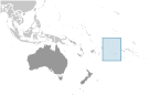
Conventional short form Cook Islands Former Harvey Islands Dependency status
Self-governing in free association with New Zealand; Cook Islands is fully responsible for internal affairs; New Zealand retains responsibility for external affairs and defense in consultation with the Cook Islands Government type
Self-governing parliamentary democracy Capital
Name Avarua
Geographic coordinates 21 12 S, 159 46 W Time difference UTC-10 (5 hours behind Washington, DC during Standard Time) Administrative divisions
None
Independence
None (became self-governing in free association with New Zealand on 4 August 1965 and has the right at any time to move to full independence by unilateral action) National holiday
Constitution Day, first Monday in August (1965) Constitution
4 August 1965
Legal system
Common law similar to New Zealand common law International law organization participation
Has not submitted an ICJ jurisdiction declaration (New Zealand normally retains responsibility for external affairs); accepts ICCt jurisdiction Suffrage
18 years of age; universal
Executive branch
Chief of state
Queen ELIZABETH II (since 6 February 1952) represented by Sir Frederick GOODWIN (since 9 February 2001); New Zealand High Commissioner John CARTER (since 29 July 2011) Head of government Prime Minister Henry PUNA (since 30 November 2010) Cabinet Cabinet chosen by the prime minister; collectively responsible to Parliament Elections The monarchy is hereditary; the UK representative appointed by the monarch; the New Zealand high commissioner appointed by the New Zealand Government; following legislative elections, the leader of the majority party or the leader of the majority coalition usually becomes prime minister Legislative branch
Bicameral Parliament consists of a House of Ariki, or upper house, made up of traditional leaders and a Legislative Assembly, or lower house, (24 seats; members elected by popular vote to serve four-year terms) Note The House of Ariki advises on traditional matters and maintains considerable influence but has no legislative powers Elections Last held on 17 November 2010 (next to be held by 2014) Election results Percent of vote by party - NA; seats by party - CIP 16, Demo 8 Judicial branch
High Court
Political parties and leaders
Cook Islands Party or CIP [Henry PUNA]; Democratic Party or Demo [Dr. Terepai MAOATE] Political pressure groups and leaders
Reform Conference (lobby for political system changes) Other Various groups lobbying for political change International organization participation
ACP, ADB, AOSIS, FAO, ICAO, ICRM, IFAD, IFRCS, IMO, IMSO, IOC, ITUC, OPCW, PIF, Sparteca, SPC, UNESCO, UPU, WHO, WMO Diplomatic representation in the us
None (self-governing in free association with New Zealand) Diplomatic representation from the us
None (self-governing in free association with New Zealand) Flag description
Blue, with the flag of the UK in the upper hoist-side quadrant and a large circle of 15 white five-pointed stars (one for every island) centered in the outer half of the flag National anthem
Name
"Te Atua Mou E" (To God Almighty) Lyrics/music Tepaeru Te RITO/Thomas DAVISNote Adopted 1982; as prime minister, Sir Thomas DAVIS composed the anthem; his wife, a tribal chief, wrote the lyrics
Comments
Add a new comment: |
Advertisement
Members area
Cook Islands [ New Zealand ] (Free Association):
 
GPS points from Cook Islands [ New Zealand ] (Free Association)
|
||||||||

 Named after Captain COOK, who sighted them in 1770, the islands became a British protectorate in 1888. By 1900, administrative control was transferred to New Zealand; in 1965, residents chose self-government in free association with New Zealand. The emigration of skilled workers to New Zealand and government deficits are continuing problems.