|
|
|
Advertisements:
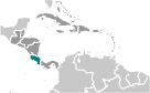
GeographyLocation
Central America, bordering both the Caribbean Sea and the North Pacific Ocean, between Nicaragua and Panama Geographic coordinates
10 00 N, 84 00 W
Map references
Central America and the Caribbean
Area World Ranking: 130
Total 51,100 sq km
Land 51,060 sq km Water 40 sq km Note Includes Isla del Coco Area - comparative
Slightly smaller than West Virginia Land boundaries
Total 639 km
Border countries Nicaragua 309 km, Panama 330 km Coastline
1,290 km
Maritime claims
Territorial sea 12 nm
Exclusive economic zone 200 nm Continental shelf 200 nm Climate
Tropical and subtropical; dry season (December to April); rainy season (May to November); cooler in highlands Terrain
Coastal plains separated by rugged mountains including over 100 volcanic cones, of which several are major volcanoes Elevation extremes
Lowest point Pacific Ocean 0 m
Highest point Cerro Chirripo 3,810 m Natural resources
Hydropower
Land use
Arable land 4.4%
Permanent crops 5.87% Other 89.73% (2005) Irrigated land
1,080 sq km (2003)
Total renewable water resources
112.4 cu km (2000)
Freshwater withdrawal (domestic/industrial/agricultural)
Total 2.68 cu km/yr (29%/17%/53%)
Per capita 619 cu m/yr (2000) Natural hazards
Occasional earthquakes, hurricanes along Atlantic coast; frequent flooding of lowlands at onset of rainy season and landslides; active volcanoes Volcanism Arenal (elev. 1,670 m), which erupted in 2010, is the most active volcano in Costa Rica; a 1968 eruption destroyed the town of Tabacon; Irazu (elev. 3,432 m), situated just east of San Jose, has the potential to spew ash over the capital city as it did between 1963 and 1965; other historically active volcanoes include Miravalles, Poas, Rincon de la Vieja, and Turrialba Environment - current issues
Deforestation and land use change, largely a result of the clearing of land for cattle ranching and agriculture; soil erosion; coastal marine pollution; fisheries protection; solid waste management; air pollution Environment - international agreements
Party to
Biodiversity, Climate Change, Climate Change-Kyoto Protocol, Desertification, Endangered Species, Environmental Modification, Hazardous Wastes, Law of the Sea, Marine Dumping, Ozone Layer Protection, Wetlands, Whaling Signed, but not ratified Marine Life ConservationGeography - note
Four volcanoes, two of them active, rise near the capital of San Jose in the center of the country; one of the volcanoes, Irazu, erupted destructively in 1963-65
Comments
Add a new comment: |
Advertisement
Members area
Costa Rica (San Jose):
 
GPS points from Costa Rica (San Jose)
|
||||||||

 Although explored by the Spanish early in the 16th century, initial attempts at colonizing Costa Rica proved unsuccessful due to a combination of factors, including: disease from mosquito-infested swamps, brutal heat, resistance by natives, and pirate raids. It was not until 1563 that a permanent settlement of Cartago was established in the cooler, fertile central highlands. The area remained a colony for some two and a half centuries. In 1821, Costa Rica became one of several Central American provinces that jointly declared their independence from Spain. Two years later it joined the United Provinces of Central America, but this federation disintegrated in 1838, at which time Costa Rica proclaimed its sovereignty and independence. Since the late 19th century, only two brief periods of violence have marred the country's democratic development. In 1949, Costa Rica dissolved its armed forces. Although it still maintains a large agricultural sector, Costa Rica has expanded its economy to include strong technology and tourism industries. The standard of living is relatively high. Land ownership is widespread.