|
|
|
Advertisements:
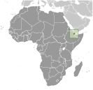
GeographyLocation
Eastern Africa, bordering the Gulf of Aden and the Red Sea, between Eritrea and Somalia Geographic coordinates
11 30 N, 43 00 E
Map references
Africa
Area World Ranking: 151
Total 23,200 sq km
Land 23,180 sq km Water 20 sq km Area - comparative
Slightly smaller than Massachusetts Land boundaries
Total 516 km
Border countries Eritrea 109 km, Ethiopia 349 km, Somalia 58 km Coastline
314 km
Maritime claims
Territorial sea 12 nm
Contiguous zone 24 nm Exclusive economic zone 200 nm Climate
Desert; torrid, dry
Terrain
Coastal plain and plateau separated by central mountains Elevation extremes
Lowest point Lac Assal -155 m
Highest point Moussa Ali 2,028 m Natural resources
Potential geothermal power, gold, clay, granite, limestone, marble, salt, diatomite, gypsum, pumice, petroleum Land use
Arable land 0.04%
Permanent crops 0% Other 99.96% (2005) Irrigated land
10 sq km (2003)
Total renewable water resources
0.3 cu km (1997)
Freshwater withdrawal (domestic/industrial/agricultural)
Total 0.02 cu km/yr (84%/0%/16%)
Per capita 25 cu m/yr (2000) Natural hazards
Earthquakes; droughts; occasional cyclonic disturbances from the Indian Ocean bring heavy rains and flash floods Volcanism Experiences limited volcanic activity; Ardoukoba (elev. 298 m) last erupted in 1978; Manda-Inakir, located along the Ethiopian border, is also historically active Environment - current issues
Inadequate supplies of potable water; limited arable land; desertification; endangered species Environment - international agreements
Party to
Biodiversity, Climate Change, Climate Change-Kyoto Protocol, Desertification, Endangered Species, Hazardous Wastes, Law of the Sea, Ozone Layer Protection, Ship Pollution, Wetlands Signed, but not ratified None of the selected agreements Geography - note
Strategic location near world's busiest shipping lanes and close to Arabian oilfields; terminus of rail traffic into Ethiopia; mostly wasteland; Lac Assal (Lake Assal) is the lowest point in Africa
Comments
Add a new comment: |
Advertisement
Members area
Djibouti (Djibouti City):
 
GPS points from Djibouti (Djibouti City)
|
||||||||

 The French Territory of the Afars and the Issas became Djibouti in 1977. Hassan Gouled APTIDON installed an authoritarian one-party state and proceeded to serve as president until 1999. Unrest among the Afars minority during the 1990s led to a civil war that ended in 2001 following the conclusion of a peace accord between Afar rebels and the Issa-dominated government. In 1999, Djibouti's first multi-party presidential elections resulted in the election of Ismail Omar GUELLEH; he was re-elected to a second term in 2005. Djibouti occupies a strategic geographic location at the mouth of the Red Sea and serves as an important transshipment location for goods entering and leaving the east African highlands. The present leadership favors close ties to France, which maintains a significant military presence in the country, but also has strong ties with the US. Djibouti hosts the only US military base in sub-Saharan Africa.