|
|
|
Advertisements:
CommunicationsTelephones - main lines in use World Ranking: 51
2.933 million (2011)
Telephones - mobile cellular World Ranking: 63
11.69 million (2011)
Telephone system
General assessment
The telephone system has been modernized; the system is digital and highly automated; trunk services are carried by fiber-optic cable and digital microwave radio relay; a program for fiber-optic subscriber connections was initiated in 1996 Domestic Competition among mobile-cellular service providers has led to a sharp increase in the use of mobile-cellular phones since 2000 and a decrease in the number of fixed-line connections International Country code - 36; Hungary has fiber-optic cable connections with all neighboring countries; the international switch is in Budapest; satellite earth stations - 2 Intelsat (Atlantic Ocean and Indian Ocean regions), 1 Inmarsat, 1 very small aperture terminal (VSAT) system of ground terminals Broadcast media
Mixed system of state-supported public service broadcast media and private broadcasters; the 3 publicly-owned TV channels and the 2 main privately-owned TV stations are the major national broadcasters; a large number of special interest channels; highly developed market for satellite and cable TV services with about two-thirds of viewers utilizing their services; 3 state-supported public-service radio networks and 2 major national commercial stations; a large number of local stations including commercial, public service, nonprofit, and community radio stations; digital transition postponed to the end of 2014 (2007) Internet country code
.hu
Internet hosts World Ranking: 33
3.064 million (2010)
Internet users World Ranking: 41
6.176 million (2009)
Comments
Add a new comment: |
Advertisement
Members area
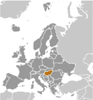
Hungary (Budapest):
 
GPS points from Hungary (Budapest)
|
||||||||

 Hungary became a Christian kingdom in A.D. 1000 and for many centuries served as a bulwark against Ottoman Turkish expansion in Europe. The kingdom eventually became part of the polyglot Austro-Hungarian Empire, which collapsed during World War I. The country fell under Communist rule following World War II. In 1956, a revolt and an announced withdrawal from the Warsaw Pact were met with a massive military intervention by Moscow. Under the leadership of Janos KADAR in 1968, Hungary began liberalizing its economy, introducing so-called "Goulash Communism." Hungary held its first multiparty elections in 1990 and initiated a free market economy. It joined NATO in 1999 and the EU five years later. In 2011, Hungary assumed the six-month rotating presidency of the EU for the first time.