|
|
|
Advertisements:
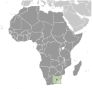
GeographyLocation
Southern Africa, an enclave of South Africa Geographic coordinates
29 30 S, 28 30 E
Map references
Africa
Area World Ranking: 142
Total 30,355 sq km
Land 30,355 sq km Water 0 sq km Area - comparative
Slightly smaller than Maryland
Land boundaries
Total 909 km
Border countries South Africa 909 km Coastline
0 km (landlocked)
Maritime claims
None (landlocked)
Climate
Temperate; cool to cold, dry winters; hot, wet summers Terrain
Mostly highland with plateaus, hills, and mountains Elevation extremes
Lowest point
Junction of the Orange and Makhaleng Rivers 1,400 m Highest point Thabana Ntlenyana 3,482 mNatural resources
Water, agricultural and grazing land, diamonds, sand, clay, building stone Land use
Arable land 10.87%
Permanent crops 0.13% Other 89% (2005) Irrigated land
30 sq km (2003)
Total renewable water resources
5.2 cu km (1987)
Freshwater withdrawal (domestic/industrial/agricultural)
Total 0.05 cu km/yr (40%/40%/20%)
Per capita 28 cu m/yr (2000) Natural hazards
Periodic droughts
Environment - current issues
Population pressure forcing settlement in marginal areas results in overgrazing, severe soil erosion, and soil exhaustion; desertification; Highlands Water Project controls, stores, and redirects water to South Africa Environment - international agreements
Party to
Biodiversity, Climate Change, Climate Change-Kyoto Protocol, Desertification, Endangered Species, Hazardous Wastes, Law of the Sea, Marine Life Conservation, Ozone Layer Protection, Wetlands Signed, but not ratified None of the selected agreements Geography - note
Landlocked, completely surrounded by South Africa; mountainous, more than 80% of the country is 1,800 m above sea level
Comments
Add a new comment: |
Advertisement
Members area
Lesotho (Maseru):
 
GPS points from Lesotho (Maseru)
|
||||||||

 Basutoland was renamed the Kingdom of Lesotho upon independence from the UK in 1966. The Basuto National Party ruled for the first two decades. King MOSHOESHOE was exiled in 1990, but returned to Lesotho in 1992 and was reinstated in 1995 and subsequently succeeded by his son, King LETSIE III, in 1996. Constitutional government was restored in 1993 after seven years of military rule. In 1998, violent protests and a military mutiny following a contentious election prompted a brief but bloody intervention by South African and Botswana military forces under the aegis of the Southern African Development Community. Subsequent constitutional reforms restored relative political stability. Peaceful parliamentary elections were held in 2002, but the National Assembly elections of February 2007 were hotly contested and aggrieved parties continue to dispute how the electoral law was applied to award proportional seats in the Assembly.