|
|
|
Advertisements:
GovernmentCountry name
Conventional long form Republic of Liberia
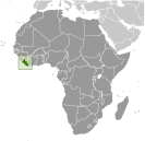
Conventional short form Liberia Government type
Republic
Capital
Name Monrovia
Geographic coordinates 6 18 N, 10 48 W Time difference UTC 0 (5 hours ahead of Washington, DC during Standard Time) Administrative divisions
15 counties; Bomi, Bong, Gbarpolu, Grand Bassa, Grand Cape Mount, Grand Gedeh, Grand Kru, Lofa, Margibi, Maryland, Montserrado, Nimba, River Cess, River Gee, Sinoe Independence
26 July 1847
Constitution
6 January 1986
Legal system
Mixed legal system of common law (based on Anglo-American law) and customary law International law organization participation
Accepts compulsory ICJ jurisdiction with reservations; accepts ICCt jurisdiction Suffrage
18 years of age; universal
Executive branch
Chief of state
President Ellen JOHNSON SIRLEAF (since 16 January 2006); Vice President Joseph BOAKAI (since 16 January 2006); note - the President is both the chief of state and head of government Head of government President Ellen JOHNSON SIRLEAF (since 16 January 2006); Vice President Joseph BOAKAI (since 16 January 2006) Cabinet Cabinet appointed by the president and confirmed by the Senate Elections President elected by popular vote for a six-year term (eligible for a second term); elections last held on 11 October and 8 November 2011 (next to be held in 2017) Election results Ellen JOHNSON SIRLEAF re-elected president; percent of vote, second round - Ellen JOHNSON SIRLEAF 90.7%, Winston TUBMAN 9.3% Legislative branch
Bicameral National Assembly consists of the Senate (30 seats; members elected by popular vote to serve nine-year terms) and the House of Representatives (73 seats; members elected by popular vote to serve six-year terms) Elections Senate - last held on 11 October 2011 (next to be held in 2014); House of Representatives - last held on 11 October 2011 (next to be held in 2017) Election results Senate - percent of vote by party - NA; seats by party - UP 10, NPP 6, CDC 3, ADP 2, NUDP 2, LDP 1, LP 1, NDC 1, NDP 1, independents 3; House of Representatives - percent of vote by party - NA; seats by party - UP 24, CDC 11, LP 7, NUDP 6, NDC 5, ADP 3, NPP 3, MPC 2, LDP 1, LTP 1, NRP 1, independents 9 Judicial branch
Supreme Court
Political parties and leaders
Alliance for Peace and Democracy or APD [Togba-na TIPOTEH]; Congress for Democratic Change or CDC [George WEAH]; Liberty Party or LP [Charles BRUMSKINE]; National Patriotic Party or NPP [Roland MASSAQUOI]; Unity Party or UP [Varney SHERMAN] Political pressure groups and leaders
Other
Demobilized former military officers International organization participation
ACP, AfDB, AU, ECOWAS, FAO, G-77, IAEA, IBRD, ICAO, ICRM, IDA, IFAD, IFC, IFRCS, ILO, IMF, IMO, IMSO, Interpol, IOC, IOM, IPU, ISO (correspondent), ITU, ITUC, MIGA, NAM, OPCW, UN, UNCTAD, UNESCO, UNIDO, UPU, WCO, WFTU, WHO, WIPO, WMO, WTO (observer) Diplomatic representation in the us
Chief of mission
Ambassador Jeremiah Congbeh SULUNTEH Chancery 5201 16th Street NW, Washington, DC 20011 Telephone [1] (202) 723-0437FAX [1] (202) 723-0436 Consulate(s) general New York Diplomatic representation from the us
Chief of mission
Ambassador Linda THOMAS-GREENFIELD Embassy 111 United Nations Drive, P. O. Box 98, Mamba Point, 1000 Monrovia, 10 Mailing address Use embassy street addressTelephone [231] 7-705-4826 FAX [231] 7-701-0370 Flag description
11 equal horizontal stripes of red (top and bottom) alternating with white; a white five-pointed star appears on a blue square in the upper hoist-side corner; the stripes symbolize the signatories of the Liberian Declaration of Independence; the blue square represents the African mainland, and the star represents the freedom granted to the ex-slaves; according to the constitution, the blue color signifies liberty, justice, and fidelity, the white color purity, cleanliness, and guilelessness, and the red color steadfastness, valor, and fervor Note The design is based on the US flag National symbol(s)
White star
National anthem
Name "All Hail, Liberia Hail!"
Lyrics/music Daniel Bashiel WARNER/Olmstead LUCA Note Lyrics adopted 1847, music adopted 1860; the anthem's author would become the third president of Liberia
Comments
Add a new comment: |
Advertisement
Members area
Liberia (Monrovia):
 
GPS points from Liberia (Monrovia)
|
||||||||

 Settlement of freed slaves from the US in what is today Liberia began in 1822; by 1847, the Americo-Liberians were able to establish a republic. William TUBMAN, president from 1944-71, did much to promote foreign investment and to bridge the economic, social, and political gaps between the descendents of the original settlers and the inhabitants of the interior. In 1980, a military coup led by Samuel DOE ushered in a decade of authoritarian rule. In December 1989, Charles TAYLOR launched a rebellion against DOE's regime that led to a prolonged civil war in which DOE himself was killed. A period of relative peace in 1997 allowed for elections that brought TAYLOR to power, but major fighting resumed in 2000. An August 2003 peace agreement ended the war and prompted the resignation of former president Charles TAYLOR, who faces war crimes charges in The Hague related to his involvement in Sierra Leone's civil war. After two years of rule by a transitional government, democratic elections in late 2005 brought President Ellen JOHNSON SIRLEAF to power. The UN Mission in Liberia (UNMIL) maintains a strong presence throughout the country, but the security situation is still fragile and the process of rebuilding the social and economic structure of this war-torn country continues.