|
|
|
Advertisements:
GeographyLocation
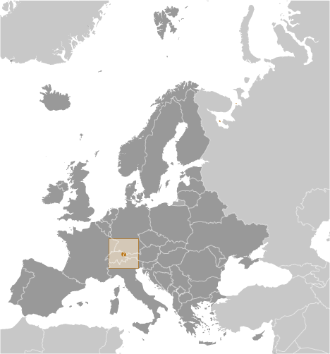
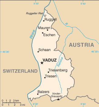
Central Europe, between Austria and Switzerland Geographic coordinates
47 16 N, 9 32 E
Map references
Europe
Area World Ranking: 218
Total 160 sq km
Land 160 sq km Water 0 sq km Area - comparative
About 0.9 times the size of Washington, DC Land boundaries
Total 76 km
Border countries Austria 34.9 km, Switzerland 41.1 km Coastline
0 km (doubly landlocked)
Maritime claims
None (landlocked)
Climate
Continental; cold, cloudy winters with frequent snow or rain; cool to moderately warm, cloudy, humid summers Terrain
Mostly mountainous (Alps) with Rhine Valley in western third Elevation extremes
Lowest point Ruggeller Riet 430 m
Highest point Vorder-Grauspitz 2,599 m Natural resources
Hydroelectric potential, arable land Land use
Arable land 25%
Permanent crops 0% Other 75% (2005) Irrigated land
NA
Natural hazards
NA
Environment - current issues
NA
Environment - international agreements
Party to
Air Pollution, Air Pollution-Nitrogen Oxides, Air Pollution-Persistent Organic Pollutants, Air Pollution-Sulfur 85, Air Pollution-Sulfur 94, Air Pollution-Volatile Organic Compounds, Biodiversity, Climate Change, Climate Change-Kyoto Protocol, Desertification, Endangered Species, Hazardous Wastes, Ozone Layer Protection, Wetlands Signed, but not ratified Law of the SeaGeography - note
Along with Uzbekistan, one of only two doubly landlocked countries in the world; variety of microclimatic variations based on elevation
Comments
Add a new comment: |
Advertisement
Members area
Liechtenstein (Vaduz):
GPS points from Liechtenstein (Vaduz)
|
||||||||
 The Principality of Liechtenstein was established within the Holy Roman Empire in 1719. Occupied by both French and Russian troops during the Napoleonic wars, it became a sovereign state in 1806 and joined the Germanic Confederation in 1815. Liechtenstein became fully independent in 1866 when the Confederation dissolved. Until the end of World War I, it was closely tied to Austria, but the economic devastation caused by that conflict forced Liechtenstein to enter into a customs and monetary union with Switzerland. Since World War II (in which Liechtenstein remained neutral), the country's low taxes have spurred outstanding economic growth. In 2000, shortcomings in banking regulatory oversight resulted in concerns about the use of financial institutions for money laundering. However, Liechtenstein implemented anti-money-laundering legislation and a Mutual Legal Assistance Treaty with the US that went into effect in 2003.