|
|
|
Advertisements:
TransportationAirports World Ranking: 70
81 (2012)
Airports - with paved runways
Total 26
Over 3,047 m 3 2,438 to 3,047 m 1 1,524 to 2,437 m 7 914 to 1,523 m 2 Under 914 m 13 (2012) Airports - with unpaved runways
Total 55
Over 3,047 m 1 914 to 1,523 m 2 Under 914 m 52 (2012) Pipelines
Gas 1,695 km; refined products 114 km (2010) Railways World Ranking: 76
Total 1,767 km
Broad gauge 1,745 km 1.524-m gauge (122 km electrified) Standard gauge 22 km 1.435-m gauge (2011)Roadways World Ranking: 58
Total 82,131 km
Paved 72,048 km (includes 309 km of expressways) Unpaved 10,083 km (2010)Waterways World Ranking: 87
441 km (navigable year round) (2007) Merchant marine World Ranking: 77
Total 38
By type Cargo 20, container 1, passenger/cargo 6, refrigerated cargo 9, roll on/roll off 2 Foreign-owned 8 (Denmark 8)Registered in other countries 22 (Antigua and Barbuda 3, Belize 1, Comoros 1, Cook Islands 1, Norway 1, Panama 3, Saint Vincent and the Grenadines 9, unknown 3) (2010) Ports and terminals
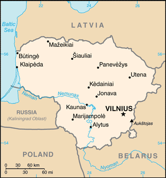
Klaipeda
Oil terminals Butinge oil terminal
Comments
Add a new comment: |
Advertisement
Members area
Lithuania (Vilnius):
GPS points from Lithuania (Vilnius)
|
||||||||
 Lithuanian lands were united under MINDAUGAS in 1236; over the next century, through alliances and conquest, Lithuania extended its territory to include most of present-day Belarus and Ukraine. By the end of the 14th century Lithuania was the largest state in Europe. An alliance with Poland in 1386 led the two countries into a union through the person of a common ruler. In 1569, Lithuania and Poland formally united into a single dual state, the Polish-Lithuanian Commonwealth. This entity survived until 1795 when its remnants were partitioned by surrounding countries. Lithuania regained its independence following World War I but was annexed by the USSR in 1940 - an action never recognized by the US and many other countries. On 11 March 1990, Lithuania became the first of the Soviet republics to declare its independence, but Moscow did not recognize this proclamation until September of 1991 (following the abortive coup in Moscow). The last Russian troops withdrew in 1993. Lithuania subsequently restructured its economy for integration into Western European institutions; it joined both NATO and the EU in the spring of 2004.