|
|
|
Advertisements:
GeographyLocation
Southern Africa, island in the Indian Ocean, east of Madagascar Geographic coordinates
20 17 S, 57 33 E
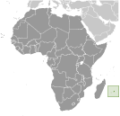
Map references
Africa
Area World Ranking: 181
Total 2,040 sq km
Land 2,030 sq km Water 10 sq km Note Includes Agalega Islands, Cargados Carajos Shoals (Saint Brandon), and Rodrigues Area - comparative
Almost 11 times the size of Washington, DC Land boundaries
0 km
Coastline
177 km
Maritime claims
Measured from claimed archipelagic straight baselines Territorial sea 12 nmExclusive economic zone 200 nm Continental shelf 200 nm or to the edge of the continental margin Climate
Tropical, modified by southeast trade winds; warm, dry winter (May to November); hot, wet, humid summer (November to May) Terrain
Small coastal plain rising to discontinuous mountains encircling central plateau Elevation extremes
Lowest point Indian Ocean 0 m
Highest point Mont Piton 828 m Natural resources
Arable land, fish
Land use
Arable land 49.02%
Permanent crops 2.94% Other 48.04% (2005) Irrigated land
210 sq km (2003)
Total renewable water resources
2.2 cu km (2001)
Freshwater withdrawal (domestic/industrial/agricultural)
Total 0.61 cu km/yr (25%/14%/60%)
Per capita 488 cu m/yr (2000) Natural hazards
Cyclones (November to April); almost completely surrounded by reefs that may pose maritime hazards Environment - current issues
Water pollution, degradation of coral reefs Environment - international agreements
Party to
Antarctic-Marine Living Resources, Biodiversity, Climate Change, Climate Change-Kyoto Protocol, Desertification, Endangered Species, Environmental Modification, Hazardous Wastes, Law of the Sea, Marine Life Conservation, Ozone Layer Protection, Ship Pollution, Wetlands Signed, but not ratified None of the selected agreements Geography - note
The main island, from which the country derives its name, is of volcanic origin and is almost entirely surrounded by coral reefs; former home of the dodo, a large flightless bird related to pigeons, driven to extinction by the end of the 17th century through a combination of hunting and the introduction of predatory species
Comments
Add a new comment: |
Advertisement
Members area
Mauritius (Port Louis):
 
GPS points from Mauritius (Port Louis)
|
||||||||

 Although known to Arab and Malay sailors as early as the 10th century, Mauritius was first explored by the Portuguese in the 16th century and subsequently settled by the Dutch - who named it in honor of Prince Maurits van NASSAU - in the 17th century. The French assumed control in 1715, developing the island into an important naval base overseeing Indian Ocean trade, and establishing a plantation economy of sugar cane. The British captured the island in 1810, during the Napoleonic Wars. Mauritius remained a strategically important British naval base, and later an air station, playing an important role during World War II for anti-submarine and convoy operations, as well as the collection of signal intelligence. Independence from the UK was attained in 1968. A stable democracy with regular free elections and a positive human rights record, the country has attracted considerable foreign investment and has earned one of Africa's highest per capita incomes.