|
|
|
Advertisements:
TransportationAirports World Ranking: 183
5 (2012)
Airports - with paved runways
Total 2
Over 3,047 m 1 914 to 1,523 m 1 (2012) Airports - with unpaved runways
Total 3
914 to 1,523 m 2 Under 914 m 1 (2012) Roadways World Ranking: 173
Total 2,066 km
Paved 2,066 km (includes 75 km of expressways) (2009) Merchant marine World Ranking: 132
Total 4
By type Passenger/cargo 2, petroleum tanker 1, refrigerated cargo 1 (2010) Ports and terminals
Port Louis
Comments
Add a new comment: |
Advertisement
Members area
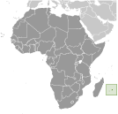
Mauritius (Port Louis):
 
GPS points from Mauritius (Port Louis)
|
||||||||

 Although known to Arab and Malay sailors as early as the 10th century, Mauritius was first explored by the Portuguese in the 16th century and subsequently settled by the Dutch - who named it in honor of Prince Maurits van NASSAU - in the 17th century. The French assumed control in 1715, developing the island into an important naval base overseeing Indian Ocean trade, and establishing a plantation economy of sugar cane. The British captured the island in 1810, during the Napoleonic Wars. Mauritius remained a strategically important British naval base, and later an air station, playing an important role during World War II for anti-submarine and convoy operations, as well as the collection of signal intelligence. Independence from the UK was attained in 1968. A stable democracy with regular free elections and a positive human rights record, the country has attracted considerable foreign investment and has earned one of Africa's highest per capita incomes.