|
|
|
Advertisements:
GeographyLocation
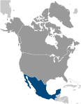
North America, bordering the Caribbean Sea and the Gulf of Mexico, between Belize and the United States and bordering the North Pacific Ocean, between Guatemala and the United States Geographic coordinates
23 00 N, 102 00 W
Map references
North America
Area World Ranking: 14
Total 1,964,375 sq km
Land 1,943,945 sq km Water 20,430 sq km Area - comparative
Slightly less than three times the size of Texas Land boundaries
Total 4,353 km
Border countries Belize 250 km, Guatemala 962 km, US 3,141 km Coastline
9,330 km
Maritime claims
Territorial sea 12 nm
Contiguous zone 24 nm Exclusive economic zone 200 nm Continental shelf 200 nm or to the edge of the continental margin Climate
Varies from tropical to desert
Terrain
High, rugged mountains; low coastal plains; high plateaus; desert Elevation extremes
Lowest point Laguna Salada -10 m
Highest point Volcan Pico de Orizaba 5,700 m Natural resources
Petroleum, silver, copper, gold, lead, zinc, natural gas, timber Land use
Arable land 12.66%
Permanent crops 1.28% Other 86.06% (2005) Irrigated land
63,000 sq km (2003)
Total renewable water resources
457.2 cu km (2000)
Freshwater withdrawal (domestic/industrial/agricultural)
Total 78.22 cu km/yr (17%/5%/77%)
Per capita 731 cu m/yr (2000) Natural hazards
Tsunamis along the Pacific coast, volcanoes and destructive earthquakes in the center and south, and hurricanes on the Pacific, Gulf of Mexico, and Caribbean coasts Volcanism Volcanic activity in the central-southern part of the country; the volcanoes in Baja California are mostly dormant; Colima (elev. 3,850 m), which erupted in 2010, is Mexico's most active volcano and is responsible for causing periodic evacuations of nearby villagers; it has been deemed a "Decade Volcano" by the International Association of Volcanology and Chemistry of the Earth's Interior, worthy of study due to its explosive history and close proximity to human populations; Popocatepetl (elev. 5,426 m) poses a threat to Mexico City; other historically active volcanoes include Barcena, Ceboruco, El Chichon, Michoacan-Guanajuato, Pico de Orizaba, San Martin, Socorro, and Tacana Environment - current issues
Scarcity of hazardous waste disposal facilities; rural to urban migration; natural freshwater resources scarce and polluted in north, inaccessible and poor quality in center and extreme southeast; raw sewage and industrial effluents polluting rivers in urban areas; deforestation; widespread erosion; desertification; deteriorating agricultural lands; serious air and water pollution in the national capital and urban centers along US-Mexico border; land subsidence in Valley of Mexico caused by groundwater depletion Note The government considers the lack of clean water and deforestation national security issues Environment - international agreements
Party to
Biodiversity, Climate Change, Climate Change-Kyoto Protocol, Desertification, Endangered Species, Hazardous Wastes, Law of the Sea, Marine Dumping, Marine Life Conservation, Ozone Layer Protection, Ship Pollution, Wetlands, Whaling Signed, but not ratified None of the selected agreements Geography - note
Strategic location on southern border of US; corn (maize), one of the world's major grain crops, is thought to have originated in Mexico
Comments
Add a new comment: |
Advertisement
Members area
Mexico (Mexico City):
 
GPS points from Mexico (Mexico City)
|
||||||||

 The site of advanced Amerindian civilizations - including the Olmec, Toltec, Teotihuacan, Zapotec, Maya, and Aztec - Mexico was conquered and colonized by Spain in the early 16th century. Administered as the Viceroyalty of New Spain for three centuries, it achieved its independence early in the 19th century. The global financial crisis beginning in late 2008 caused a massive economic downturn the following year, although growth returned quickly in 2010. Ongoing economic and social concerns include low real wages, underemployment for a large segment of the population, inequitable income distribution, and few advancement opportunities for the largely Amerindian population in the impoverished southern states. The elections held in 2000 marked the first time since the 1910 Mexican Revolution that an opposition candidate - Vicente FOX of the National Action Party (PAN) - defeated the party in government, the Institutional Revolutionary Party (PRI). He was succeeded in 2006 by another PAN candidate Felipe CALDERON. National elections, including the presidential election, are scheduled for 1 July 2012. Since 2007, Mexico's powerful drug-trafficking organizations have engaged in bloody feuding, resulting in tens of thousands of drug-related homicides.