|
|
|
Advertisements:
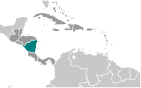
GeographyLocation
Central America, bordering both the Caribbean Sea and the North Pacific Ocean, between Costa Rica and Honduras Geographic coordinates
13 00 N, 85 00 W
Map references
Central America and the Caribbean
Area World Ranking: 98
Total 130,370 sq km
Land 119,990 sq km Water 10,380 sq km Area - comparative
Slightly smaller than New York state Land boundaries
Total 1,231 km
Border countries Costa Rica 309 km, Honduras 922 km Coastline
910 km
Maritime claims
Territorial sea 12 nm
Contiguous zone 24 nm Continental shelf Natural prolongation Climate
Tropical in lowlands, cooler in highlands Terrain
Extensive Atlantic coastal plains rising to central interior mountains; narrow Pacific coastal plain interrupted by volcanoes Elevation extremes
Lowest point Pacific Ocean 0 m
Highest point Mogoton 2,438 m Natural resources
Gold, silver, copper, tungsten, lead, zinc, timber, fish Land use
Arable land 14.81%
Permanent crops 1.82% Other 83.37% (2005) Irrigated land
610 sq km (2003)
Total renewable water resources
196.7 cu km (2000)
Freshwater withdrawal (domestic/industrial/agricultural)
Total 1.3 cu km/yr (15%/2%/83%)
Per capita 237 cu m/yr (2000) Natural hazards
Destructive earthquakes; volcanoes; landslides; extremely susceptible to hurricanes Volcanism Significant volcanic activity; Cerro Negro (elev. 728 m), which last erupted in 1999, is one of Nicaragua's most active volcanoes; its lava flows and ash have been known to cause significant damage to farmland and buildings; other historically active volcanoes include Concepcion, Cosiguina, Las Pilas, Masaya, Momotombo, San Cristobal, and Telica Environment - current issues
Deforestation; soil erosion; water pollution Environment - international agreements
Party to
Biodiversity, Climate Change, Climate Change-Kyoto Protocol, Desertification, Endangered Species, Environmental Modification, Hazardous Wastes, Law of the Sea, Ozone Layer Protection, Ship Pollution, Wetlands, Whaling Signed, but not ratified None of the selected agreements Geography - note
Largest country in Central America; contains the largest freshwater body in Central America, Lago de Nicaragua
Comments
Add a new comment: |
Advertisement
Members area
Nicaragua (Managua):
 
GPS points from Nicaragua (Managua)
|
||||||||

 The Pacific coast of Nicaragua was settled as a Spanish colony from Panama in the early 16th century. Independence from Spain was declared in 1821 and the country became an independent republic in 1838. Britain occupied the Caribbean Coast in the first half of the 19th century, but gradually ceded control of the region in subsequent decades. Violent opposition to governmental manipulation and corruption spread to all classes by 1978 and resulted in a short-lived civil war that brought the Marxist Sandinista guerrillas to power in 1979. Nicaraguan aid to leftist rebels in El Salvador caused the US to sponsor anti-Sandinista contra guerrillas through much of the 1980s. After losing free and fair elections in 1990, 1996, and 2001, former Sandinista President Daniel ORTEGA Saavedra was elected president in 2006 and reelected in 2011. The 2008 municipal elections, 2010 regional elections, and November 2011 presidential elections were marred by widespread irregularities. Nicaragua's infrastructure and economy - hard hit by the earlier civil war and by Hurricane Mitch in 1998 - are slowly being rebuilt, but democratic institutions have been weakened under the ORTEGA administration.