|
|
|
Advertisements:
TransportationAirports World Ranking: 40
143 (2012)
Airports - with paved runways
Total 11
2,438 to 3,047 m 3 1,524 to 2,437 m 2 914 to 1,523 m 2 Under 914 m 4 (2012) Airports - with unpaved runways
Total 132
1,524 to 2,437 m 1 914 to 1,523 m 16 Under 914 m 115 (2012) Pipelines
Oil 54 km (2010)
Roadways World Ranking: 112
Total 19,137 km
Paved 2,033 km Unpaved 17,104 km (2009) Waterways World Ranking: 40
2,220 km (navigable waterways as well as the use of the large Lake Managua and Lake Nicaragua; rivers serve only the sparsely populated eastern part of the country) (2011) Ports and terminals
Bluefields, Corinto
Comments
Add a new comment: |
Advertisement
Members area
Nicaragua (Managua):
 
GPS points from Nicaragua (Managua)
|
||||||||

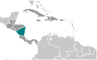 The Pacific coast of Nicaragua was settled as a Spanish colony from Panama in the early 16th century. Independence from Spain was declared in 1821 and the country became an independent republic in 1838. Britain occupied the Caribbean Coast in the first half of the 19th century, but gradually ceded control of the region in subsequent decades. Violent opposition to governmental manipulation and corruption spread to all classes by 1978 and resulted in a short-lived civil war that brought the Marxist Sandinista guerrillas to power in 1979. Nicaraguan aid to leftist rebels in El Salvador caused the US to sponsor anti-Sandinista contra guerrillas through much of the 1980s. After losing free and fair elections in 1990, 1996, and 2001, former Sandinista President Daniel ORTEGA Saavedra was elected president in 2006 and reelected in 2011. The 2008 municipal elections, 2010 regional elections, and November 2011 presidential elections were marred by widespread irregularities. Nicaragua's infrastructure and economy - hard hit by the earlier civil war and by Hurricane Mitch in 1998 - are slowly being rebuilt, but democratic institutions have been weakened under the ORTEGA administration.