|
|
|
Advertisements:
GeographyLocation
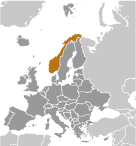
Northern Europe, bordering the North Sea and the North Atlantic Ocean, west of Sweden Geographic coordinates
62 00 N, 10 00 E
Map references
Europe
Area World Ranking: 68
Total 323,802 sq km
Land 304,282 sq km Water 19,520 sq km Area - comparative
Slightly larger than New Mexico Land boundaries
Total 2,542 km
Border countries Finland 727 km, Sweden 1,619 km, Russia 196 km Coastline
25,148 km (includes mainland 2,650 km, as well as long fjords, numerous small islands, and minor indentations 22,498 km; length of island coastlines 58,133 km) Maritime claims
Territorial sea 12 nm
Contiguous zone 10 nm Exclusive economic zone 200 nm Continental shelf 200 nm Climate
Temperate along coast, modified by North Atlantic Current; colder interior with increased precipitation and colder summers; rainy year-round on west coast Terrain
Glaciated; mostly high plateaus and rugged mountains broken by fertile valleys; small, scattered plains; coastline deeply indented by fjords; arctic tundra in north Elevation extremes
Lowest point Norwegian Sea 0 m
Highest point Galdhopiggen 2,469 m Natural resources
Petroleum, natural gas, iron ore, copper, lead, zinc, titanium, pyrites, nickel, fish, timber, hydropower Land use
Arable land 2.7%
Permanent crops 0% Other 97.3% (2005) Irrigated land
1,180 sq km (2003)
Total renewable water resources
381.4 cu km (2005)
Freshwater withdrawal (domestic/industrial/agricultural)
Total 2.4 cu km/yr (23%/67%/10%)
Per capita 519 cu m/yr (1996) Natural hazards
Rockslides, avalanches
Volcanism Beerenberg (elev. 2,227 m) on Jan Mayen Island in the Norwegian Sea is the country's only active volcano Environment - current issues
Water pollution; acid rain damaging forests and adversely affecting lakes, threatening fish stocks; air pollution from vehicle emissions Environment - international agreements
Party to
Air Pollution, Air Pollution-Nitrogen Oxides, Air Pollution-Persistent Organic Pollutants, Air Pollution-Sulfur 85, Air Pollution-Sulfur 94, Air Pollution-Volatile Organic Compounds, Antarctic-Environmental Protocol, Antarctic-Marine Living Resources, Antarctic Seals, Antarctic Treaty, Biodiversity, Climate Change, Climate Change-Kyoto Protocol, Desertification, Endangered Species, Environmental Modification, Hazardous Wastes, Law of the Sea, Marine Dumping, Ozone Layer Protection, Ship Pollution, Tropical Timber 83, Tropical Timber 94, Wetlands, Whaling Signed, but not ratified None of the selected agreements Geography - note
About two-thirds mountains; some 50,000 islands off its much-indented coastline; strategic location adjacent to sea lanes and air routes in North Atlantic; one of the most rugged and longest coastlines in the world
Comments
Add a new comment: |
Advertisement
Members area
Norway (Oslo):
 
GPS points from Norway (Oslo)
|
||||||||

 Two centuries of Viking raids into Europe tapered off following the adoption of Christianity by King Olav TRYGGVASON in 994. Conversion of the Norwegian kingdom occurred over the next several decades. In 1397, Norway was absorbed into a union with Denmark that lasted more than four centuries. In 1814, Norwegians resisted the cession of their country to Sweden and adopted a new constitution. Sweden then invaded Norway but agreed to let Norway keep its constitution in return for accepting the union under a Swedish king. Rising nationalism throughout the 19th century led to a 1905 referendum granting Norway independence. Although Norway remained neutral in World War I, it suffered heavy losses to its shipping. Norway proclaimed its neutrality at the outset of World War II, but was nonetheless occupied for five years by Nazi Germany (1940-45). In 1949, neutrality was abandoned and Norway became a member of NATO. Discovery of oil and gas in adjacent waters in the late 1960s boosted Norway's economic fortunes. In referenda held in 1972 and 1994, Norway rejected joining the EU. Key domestic issues include immigration and integration of ethnic minorities, maintaining the country's extensive social safety net with an aging population, and preserving economic competitiveness.