|
|
Advertisements:
GeographyLocation
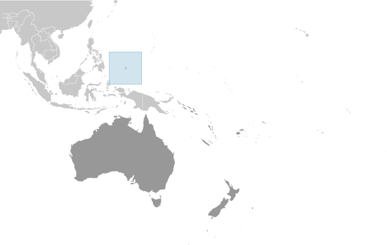
Oceania, group of islands in the North Pacific Ocean, southeast of the Philippines Geographic coordinates
7 30 N, 134 30 E
Map references
Oceania
Area World Ranking: 197
Total 459 sq km
Land 459 sq km Water 0 sq km Area - comparative
Slightly more than 2.5 times the size of Washington, DC Land boundaries
0 km
Coastline
1,519 km
Maritime claims
Territorial sea 3 nm
Exclusive fishing zone 200 nm Climate
Tropical; hot and humid; wet season May to November Terrain
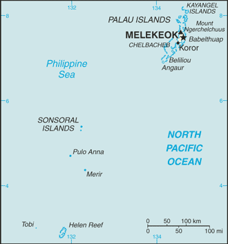
Varying geologically from the high, mountainous main island of Babelthuap to low, coral islands usually fringed by large barrier reefs Elevation extremes
Lowest point Pacific Ocean 0 m
Highest point Mount Ngerchelchuus 242 m Natural resources
Forests, minerals (especially gold), marine products, deep-seabed minerals Land use
Arable land 8.7%
Permanent crops 4.35% Other 86.95% (2005) Irrigated land
NA
Natural hazards
Typhoons (June to December)
Environment - current issues
Inadequate facilities for disposal of solid waste; threats to the marine ecosystem from sand and coral dredging, illegal fishing practices, and overfishing Environment - international agreements
Party to
Biodiversity, Climate Change, Climate Change-Kyoto Protocol, Desertification, Law of the Sea, Ozone Layer Protection, Wetlands, Whaling Signed, but not ratified None of the selected agreements Geography - note
Westernmost archipelago in the Caroline chain, consists of six island groups totaling more than 300 islands; includes World War II battleground of Beliliou (Peleliu) and world-famous rock islands
Comments
Add a new comment: |
Advertisement
Members area
Palau (Koror):
 
GPS points from Palau (Koror)
|
||||||||

 After three decades as part of the UN Trust Territory of the Pacific under US administration, this westernmost cluster of the Caroline Islands opted for independence in 1978 rather than join the Federated States of Micronesia. A Compact of Free Association with the US was approved in 1986 but not ratified until 1993. It entered into force the following year when the islands gained independence.