|
|
|
Advertisements:
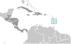
GeographyLocation
Caribbean, island between the Caribbean Sea and North Atlantic Ocean, north of Trinidad and Tobago Geographic coordinates
13 53 N, 60 58 W
Map references
Central America and the Caribbean
Area World Ranking: 193
Total 616 sq km
Land 606 sq km Water 10 sq km Area - comparative
Three and a half times the size of Washington, DC Land boundaries
0 km
Coastline
158 km
Maritime claims
Territorial sea 12 nm
Contiguous zone 24 nm Exclusive economic zone 200 nm Continental shelf 200 nm or to the edge of the continental margin Climate
Tropical, moderated by northeast trade winds; dry season January to April, rainy season May to August Terrain
Volcanic and mountainous with some broad, fertile valleys Elevation extremes
Lowest point Caribbean Sea 0 m
Highest point Mount Gimie 950 m Natural resources
Forests, sandy beaches, minerals (pumice), mineral springs, geothermal potential Land use
Arable land 6.45%
Permanent crops 22.58% Other 70.97% (2005) Irrigated land
30 sq km (2003)
Freshwater withdrawal (domestic/industrial/agricultural)
Total 0.01
Per capita 81 cu m/yr (1997) Natural hazards
Hurricanes; volcanic activity
Environment - current issues
Deforestation; soil erosion, particularly in the northern region Environment - international agreements
Party to
Biodiversity, Climate Change, Climate Change-Kyoto Protocol, Desertification, Endangered Species, Environmental Modification, Hazardous Wastes, Law of the Sea, Marine Dumping, Ozone Layer Protection, Ship Pollution, Wetlands, Whaling Signed, but not ratified None of the selected agreements Geography - note
The twin Pitons (Gros Piton and Petit Piton), striking cone-shaped peaks south of Soufriere, are one of the scenic natural highlights of the Caribbean
Comments
Add a new comment: |
Advertisement
Members area
Saint Lucia (Castries):
 
GPS points from Saint Lucia (Castries)
|
||||||||

 The island, with its fine natural harbor at Castries, was contested between England and France throughout the 17th and early 18th centuries (changing possession 14 times); it was finally ceded to the UK in 1814. Even after the abolition of slavery on its plantations in 1834, Saint Lucia remained an agricultural island, dedicated to producing tropical commodity crops. Self-government was granted in 1967 and independence in 1979.