|
|
|
Advertisements:
GeographyLocation
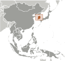
Eastern Asia, southern half of the Korean Peninsula bordering the Sea of Japan and the Yellow Sea Geographic coordinates
37 00 N, 127 30 E
Map references
Asia
Area World Ranking: 109
Total 99,720 sq km
Land 96,920 sq km Water 2,800 sq km Area - comparative
Slightly larger than Indiana
Land boundaries
Total 238 km
Border countries North Korea 238 km Coastline
2,413 km
Maritime claims
Territorial sea
12 nm; between 3 nm and 12 nm in the Korea Strait Contiguous zone 24 nmExclusive economic zone 200 nm Continental shelf Not specified Climate
Temperate, with rainfall heavier in summer than winter Terrain
Mostly hills and mountains; wide coastal plains in west and south Elevation extremes
Lowest point Sea of Japan 0 m
Highest point Halla-san 1,950 m Natural resources
Coal, tungsten, graphite, molybdenum, lead, hydropower potential Land use
Arable land 16.58%
Permanent crops 2.01% Other 81.41% (2005) Irrigated land
8,320 sq km (2003)
Total renewable water resources
69.7 cu km (1999)
Freshwater withdrawal (domestic/industrial/agricultural)
Total 18.59 cu km/yr (36%/16%/48%)
Per capita 389 cu m/yr (2000) Natural hazards
Occasional typhoons bring high winds and floods; low-level seismic activity common in southwest Volcanism Halla (elev. 1,950 m) is considered historically active although it has not erupted in many centuries Environment - current issues
Air pollution in large cities; acid rain; water pollution from the discharge of sewage and industrial effluents; drift net fishing Environment - international agreements
Party to
Antarctic-Environmental Protocol, Antarctic-Marine Living Resources, Antarctic Treaty, Biodiversity, Climate Change, Climate Change-Kyoto Protocol, Desertification, Endangered Species, Environmental Modification, Hazardous Wastes, Law of the Sea, Marine Dumping, Ozone Layer Protection, Ship Pollution, Tropical Timber 83, Tropical Timber 94, Wetlands, Whaling Signed, but not ratified None of the selected agreements Geography - note
Strategic location on Korea Strait
Comments
Add a new comment: |
Advertisement
Members area
South Korea (Seoul):
 
GPS points from South Korea (Seoul)
|
||||||||

 An independent kingdom for much of its long history, Korea was occupied by Japan beginning in 1905 following the Russo-Japanese War. In 1910, Tokyo formally annexed the entire Peninsula. Korea regained its independence following Japan's surrender to the United States in 1945. After World War II, a democratic-based government (Republic of Korea, ROK) was set up in the southern half of the Korean Peninsula while a Communist-style government was installed in the north (the DPRK). During the Korean War (1950-53), US troops and UN forces fought alongside soldiers from the ROK to defend South Korea from DPRK attacks supported by China and the Soviet Union. An armistice was signed in 1953, splitting the peninsula along a demilitarized zone at about the 38th parallel. Thereafter, South Korea under the PARK Chung-hee regime achieved rapid economic growth with per capita income rising to roughly 17 times the level of North Korea. In 1993, KIM Young-sam became South Korea's first civilian president following 32 years of military rule. South Korea today is a fully functioning modern democracy. President LEE Myung-bak has pursued a policy of global engagement since taking office in February 2008, highlighted by Seoul's hosting of the G-20 summit in November 2010 and the Nuclear Security Summit in March 2012, as well as the forthcoming 2018 Winter Olympic Games. Serious tensions with North Korea have punctuated inter-Korean relations in recent years, including the North's sinking of the South Korean warship Cheonan in March 2010 and its artillery attack on South Korean soldiers and citizens in November 2010.