|
|
|
Advertisements:
CommunicationsTelephones - main lines in use
NA
Telephone system
General assessment Adequate
Domestic Local telephone service International Country code - 47-790; satellite earth station - 1 of unknown type (for communication with Norwegian mainland only) Broadcast media
The Norwegian Broadcasting Corporation (NRK) began direct TV transmission to Svalbard via satellite in 1984; Longyearbyen households have access to 3 NRK radio and 2 TV stations (2008) Internet country code
.sj
Comments
Add a new comment: |
Advertisement
Members area
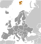
Svalbard [ Norway ] (Norway):
 
GPS points from Svalbard [ Norway ] (Norway)
|
||||||||

 First discovered by the Norwegians in the 12th century, the islands served as an international whaling base during the 17th and 18th centuries. Norway's sovereignty was recognized in 1920; five years later it officially took over the territory.