|
|
|
Advertisements:
TransportationAirports World Ranking: 187
4 (2012)
Airports - with paved runways
Total 1
2,438 to 3,047 m 1 (2012) Airports - with unpaved runways
Total 3
Under 914 m 3 (2012) Heliports
1 (2012)
Ports and terminals
Barentsburg, Longyearbyen, Ny-Alesund, Pyramiden
Comments
Add a new comment: |
Advertisement
Members area
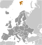
Svalbard [ Norway ] (Norway):
 
GPS points from Svalbard [ Norway ] (Norway)
|
||||||||

 First discovered by the Norwegians in the 12th century, the islands served as an international whaling base during the 17th and 18th centuries. Norway's sovereignty was recognized in 1920; five years later it officially took over the territory.