English   Română   Español   Français   Deutsch  

getamap.net

Africa

Oceania

Asia

North America

Europe

South America

Antarctica


Camp Borrut

(Pic Negre) / Andorra (general)

42°27'0" N
1°34'0" E
~2,558m asl
05:55 (CEST - UTC/GMT+2)

Camp Borrut (Camp Borrut) is a locality (class L - Area) in Andorra (general), Andorra (Europe) with the region font code of Americas/Western Europe. It is located at an elevation of 2,558 meters above sea level.
Camp Borrut is also known as Pic Negre.

Its coordinates are 42°27'0" N and 1°34'0" E in DMS (Degrees Minutes Seconds) or 42.45 and 1.56667 (in decimal degrees). Its UTM position is CH80 and its Joint Operation Graphics reference is NK31-04.

Current local time is 05:55; the sun rises at 07:55 and sets at 20:02 local time (Europe/Andorra UTC/GMT+2). The standard time zone for Camp Borrut is UTC/GMT+1, but since Daylight Saving Time (DST) is in effect the current time zone is UTC/GMT+2.
In 2024 DST starts on 31 Mar 2024 and ends on 27 Oct 2024.

A Locality is a minor area or place of unspecified or mixed character and indefinite boundaries.


Country
 Advertisements:


 Advertisements:


Weather Camp Borrut (Cloud cover, Temperature, Wind speed and Precipitation mm probab.)

Fri


Apr 19
Clound 0-0-0-0
 
-5 °C min
2 °C max
8 km/h
Thu Jan 1

Sat


Apr 20
Clound 0-0-0-0
 
-11 °C min
2 °C max
14 km/h
Thu Jan 1

Sun


Apr 21
Clound 0-10-0-0
 
-11 °C min
1 °C max
16 km/h
Thu Jan 1

Mon


Apr 22
Clound 0-20-10-0 Mist
~0.4 l/m2 22%
 
-16 °C min
-6 °C max
17 km/h
Thu Jan 1

Tue


Apr 23
Clound 10-50-50-20 Mist
~0.4 l/m2 33%
 
-16 °C min
-5 °C max
13 km/h
Thu Jan 1

Wed


Apr 24
Clound 0-30-10-10 Mist
~1 l/m2 33%
 
1 cm (Snow)
-15 °C min
-1 °C max
14 km/h
Thu Jan 1

Weather Graph

Pic Negre (Andorra (general)) 7 day forecast
 

Map and Photos Camp Borrut


Comments

--- There are no comments yet ---


Add a new comment:


You have to log in to add a comment!


Members area


Register

Forgot password?

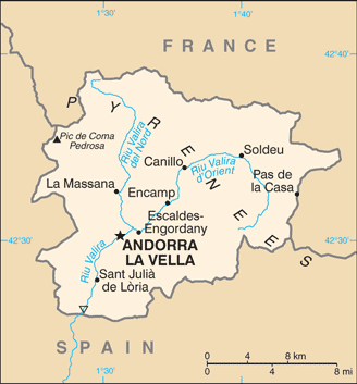
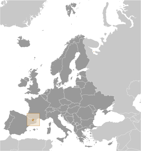
Andorra (Andorra La Vella):

Advertisement


GPS points near Camp Borrut

GPS points from Andorra (Andorra La Vella)

square Port De L' Angonella Andorra (general)

square Tossal D' Encampdana Andorra (general)

square Pont De L' Aiguerola Andorra (general)

square Collada De L' Estall Andorra (general)

square Estany De Les Truites Andorra (general)

square Canal Del Cortal Vell Andorra (general)

square Torrent De Ribassols Andorra (general)

square Canal De Roca Major Parroquia De Sant Julia De Loria


viewweather.com sv.ViewWeather.com
fr.ViewWeather.com
da.ViewWeather.com
de.ViewWeather.com
es.ViewWeather.com
www.carpati.org
www.searchromania.net
Deblocari usi
es.getamap.org
fr.getamap.org
de.getamap.org
nl.getamap.org
da.getamap.org
www.getamap.org
Links
Terms of use
Privacy policy

# 0.0666 sec 

contact AT getamap.net

© 2006 - 2024  https://www.getamap.net/