40°4'60" N
45°55'0" E
~2,609m asl
07:49 (AMT - UTC/GMT+4)
Sarqi Gojca Silsilasi (Şǝrqi Göjcǝ Silsilǝsi) is a mountains (class T - Hypsographic) in Armenia (general), Armenia (Asia) with the region font code of Russia/ Central Asia. It is located at an elevation of 2,609 meters above sea level.
Şǝrqi Göjcǝ Silsilǝsi is also known as Arevelyan Sevani Lerrnashght'a, Arevelyan Sevani Lerrnashght’a, Gontur Lerrnashght'a, Gontur Lerrnashght’a, Guntur Lerrnashght'a, Guntur Lerrnashght’a, K'unkur Lerrnashght'a, Kongur Lerrnashght'a, Kongur Lerrnashght’a, K’unkur Lerrnashght’a, Sarqi Gojca Silsilasi, Sarqi Sevan Silsilasi, Vostochno-Sevanskiy Khrebet, Şərqi Göjcə Silsiləsi, Şərqi Sevan Silsiləsi.
Its coordinates are 40°4'60" N and 45°55'0" E in DMS (Degrees Minutes Seconds) or 40.0833 and 45.9167 (in decimal degrees). Its UTM position is NK73 and its Joint Operation Graphics reference is NK38-11.
Current local time is 07:49; the sun rises at 08:54 and sets at 21:01 local time (Asia/Yerevan UTC/GMT+4). The standard time zone for Sarqi Gojca Silsilasi is UTC/GMT+4
In 2024 DST starts on - and ends on -.
A Mountains is a mountain range or a group of mountains or high ridges.
|
Advertisements:
Advertisements:
|
Weather Şǝrqi Göjcǝ Silsilǝsi (Cloud cover, Temperature, Wind speed and Precipitation mm probab.)
Tue
Apr 23
~1 l/m2 26%
4 °C min
5 °C max
10 km/h
Thu Jan 1
|
Wed
Apr 24
~2 l/m2 27%
0 °C min
11 °C max
10 km/h
Thu Jan 1
|
Thu
Apr 25
2 °C min
13 °C max
9 km/h
Thu Jan 1
|
Fri
Apr 26
~3 l/m2 34%
4 °C min
15 °C max
8 km/h
Thu Jan 1
|
Sat
Apr 27
~9 l/m2 51%
4 °C min
13 °C max
11 km/h
Thu Jan 1
|
Sun
Apr 28
~1 l/m2 22%
2 °C min
13 °C max
8 km/h
Thu Jan 1
|
|
|
Arevelyan Sevani Lerrnashght'a (Armenia (general)) 7 day forecast
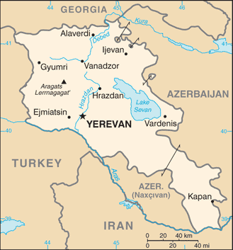
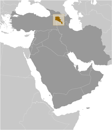
Map and Photos Sarqi Gojca Silsilasi
--- There are no comments yet ---
Add a new comment:
|
Members area
Armenia (Yerevan):
Advertisement
GPS points near Şǝrqi Göjcǝ Silsilǝsi
GPS points from Armenia (Yerevan)
 Darb Vayots' Dzori Marz
|