26°8'40" N
50°38'31" E
~0m asl
22:31 (AST - UTC/GMT+3)
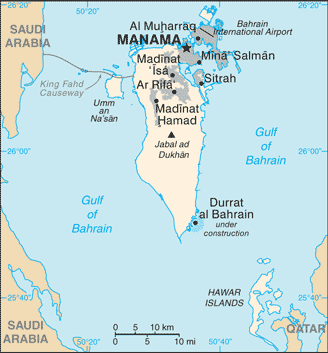
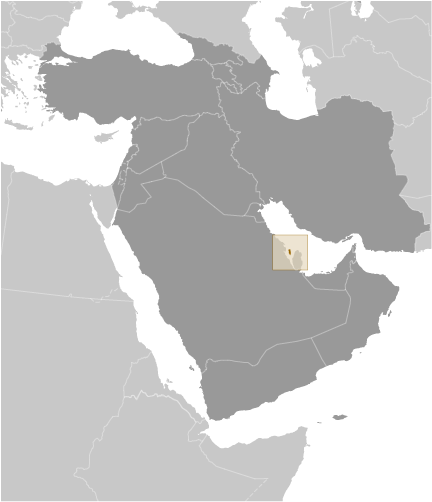
Sitrah Anchorage (Sitrah Anchorage) is a oil pipeline terminal (class S - Spot Feature) in Ash Shamaliyah (Sitrah), Bahrain (Asia) with the region font code of Africa/Middle East...
Sitrah Anchorage is also known as Port of Sitra, Port of Sitrah, Sitra, Sitra Oil Loading Terminal, Sitra Terminal, Sitrah, Sitrah Anchorage, sitrat, سِتْرَة.
Its coordinates are 26°8'40" N and 50°38'31" E in DMS (Degrees Minutes Seconds) or 26.1444 and 50.6419 (in decimal degrees). Its UTM position is VJ69 and its Joint Operation Graphics reference is NG39-06.
Current local time is 22:31; the sun rises at 08:55 and sets at 21:02 local time (Asia/Bahrain UTC/GMT+3). The standard time zone for Sitrah Anchorage is UTC/GMT+3
In 2024 DST starts on - and ends on -.
A Oil pipeline terminal is a tank farm or loading facility at the end of an oil pipeline.
|
Advertisements:
Advertisements:
|
Weather Sitrah Anchorage (Cloud cover, Temperature, Wind speed and Precipitation mm probab.)
Fri
Apr 19
27 °C min
28 °C max
20 km/h
Thu Jan 1
|
Sat
Apr 20
25 °C min
30 °C max
20 km/h
Thu Jan 1
|
Sun
Apr 21
25 °C min
30 °C max
27 km/h
Thu Jan 1
|
Mon
Apr 22
25 °C min
31 °C max
33 km/h
Thu Jan 1
|
Tue
Apr 23
24 °C min
28 °C max
38 km/h
Thu Jan 1
|
Wed
Apr 24
25 °C min
30 °C max
23 km/h
Thu Jan 1
|
|
|
Sitrah (Ash Shamaliyah) 7 day forecast
Map and Photos Sitrah Anchorage
--- There are no comments yet ---
Add a new comment:
|
Members area
Bahrain (Manama):
Advertisement
GPS points near Sitrah Anchorage
GPS points from Bahrain (Manama)
|
 Bandar ad Da (1 km)