53°54'0" N
23°46'60" E
~122m asl
14:28 (FET - UTC/GMT+3)
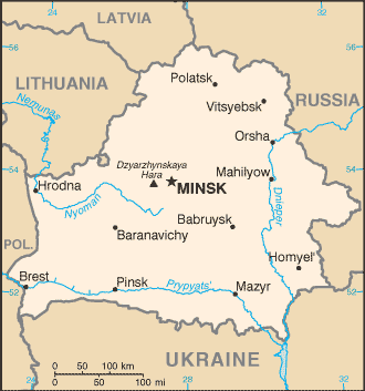
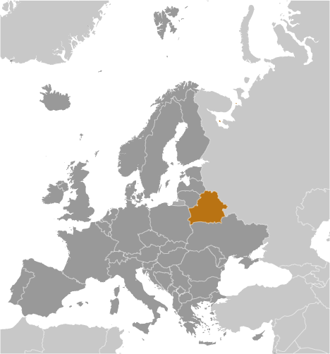
Charna Khanga (Charna Khanga) is a stream (class H - Hydrographic) in Belarus (general), Belarus (Europe) with the region font code of Eastern Europe. It is located at an elevation of 122 meters above sea level.
Charna Khanga is also known as Charna Khanga, Chernaya Gan'cha, Chernaya Gancha, Chërnaya Gancha, Chërnaya Gan’cha, Czarna Hancza, Czarna Hańcza, Reka Charna-Khanga.
Its coordinates are 53°54'0" N and 23°46'60" E in DMS (Degrees Minutes Seconds) or 53.9 and 23.7833 (in decimal degrees). Its UTM position is FE87 and its Joint Operation Graphics reference is NN34-09.
Current local time is 14:28; the sun rises at 08:55 and sets at 21:02 local time (Europe/Minsk UTC/GMT+3). The standard time zone for Charna Khanga is UTC/GMT+3
In 2024 DST starts on - and ends on -.
A Stream is a body of running water moving to a lower level in a channel on land.
|
Advertisements:
Advertisements:
|
Weather Charna Khanga (Cloud cover, Temperature, Wind speed and Precipitation mm probab.)
Thu
Apr 18
~3 l/m2 60%
4 °C min
8 °C max
15 km/h
Thu Jan 1
|
Fri
Apr 19
~8 l/m2 74%
3 °C min
10 °C max
20 km/h
Thu Jan 1
|
Sat
Apr 20
~3 l/m2 65%
3 °C min
7 °C max
12 km/h
Thu Jan 1
|
Sun
Apr 21
~2 l/m2 56%
3 °C min
15 °C max
14 km/h
Thu Jan 1
|
Mon
Apr 22
~7 l/m2 75%
1 °C min
9 °C max
33 km/h
Thu Jan 1
|
Tue
Apr 23
~11 l/m2 77%
3-8 cm (Snow)
-1 °C min
4 °C max
24 km/h
Thu Jan 1
|
|
|
Chernaya Gan'cha (Belarus (general)) 7 day forecast
Map and Photos Charna Khanga
--- There are no comments yet ---
Add a new comment:
|
Members area
Belarus (Minsk):
Advertisement
GPS points near Charna Khanga
GPS points from Belarus (Minsk)
 Butily Hrodzyenskaya Voblasts'
Paluzh Mahilyowskaya Voblasts'
|