|
|
|
Advertisements:
Administrative divisions (28,360 GPS Maps)
Comments
Add a new comment: |
Advertisement
Members area
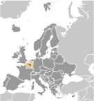
Belgium (Brussels):
 
GPS points from Belgium (Brussels)
|
||||||||
|
|
|
Advertisements:
Administrative divisions (28,360 GPS Maps)
Comments
Add a new comment: |
Advertisement
Members area
Belgium (Brussels):
GPS points from Belgium (Brussels)
|
||||||||

 Belgium became independent from the Netherlands in 1830; it was occupied by Germany during World Wars I and II. The country prospered in the past half century as a modern, technologically advanced European state and member of NATO and the EU. Tensions between the Dutch-speaking Flemings of the north and the French-speaking Walloons of the south have led in recent years to constitutional amendments granting these regions formal recognition and autonomy.