54°26'40" S
3°24'57" E
~302m asl
( - UTC/GMT+)
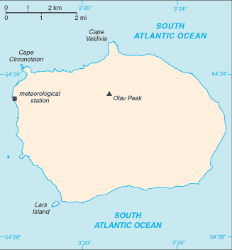
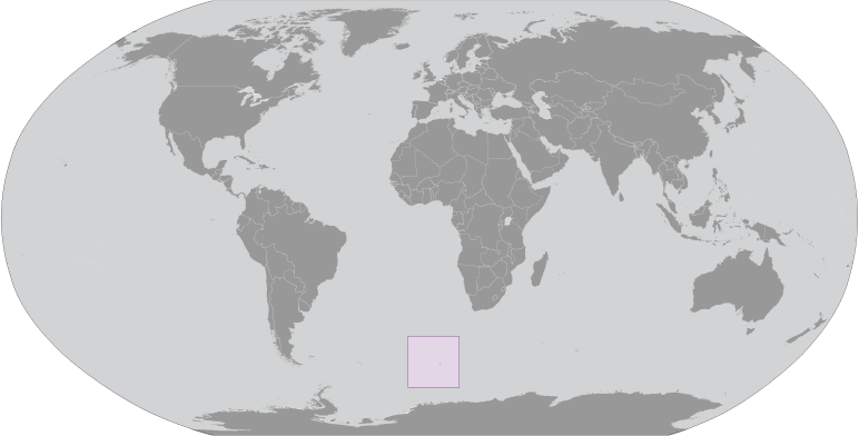
Discovery Point (Discovery Point) is a cape (class T - Hypsographic) in Bouvetoya (general) (Bouvet Island (general)), Bouvet Island [ Norway ] (Antarctica) with the region font code of Americas/Western Europe. It is located at an elevation of 302 meters above sea level.
Discovery Point is also known as Cap Fie, Cape Fie, Discovery Point.
Its coordinates are 54°26'40" S and 3°24'57" E in DMS (Degrees Minutes Seconds) or -54.4444 and 3.41583 (in decimal degrees). Its UTM position is EV26 and its Joint Operation Graphics reference is SN31-08.
Current local time is ; the sun rises at 08:54 and sets at 21:01 local time ( UTC/GMT+). The standard time zone for Discovery Point is UTC/GMT+
In 2024 DST starts on - and ends on -.
A Cape is a land area, more prominent than a point, projecting into the sea and marking a notable change in coastal direction.
|
Advertisements:
Advertisements:
|
Weather Discovery Point (Cloud cover, Temperature, Wind speed and Precipitation mm probab.)
Tue
Apr 23
~8 l/m2 73%
2 °C min
4 °C max
53 km/h
Thu Jan 1
|
Wed
Apr 24
~3 l/m2 60%
1 °C min
2 °C max
85 km/h
Thu Jan 1
|
Thu
Apr 25
~1 l/m2 55%
0 °C min
2 °C max
66 km/h
Thu Jan 1
|
Fri
Apr 26
~20 l/m2 97%
4-11 cm (Snow)
0 °C min
3 °C max
42 km/h
Thu Jan 1
|
Sat
Apr 27
~0.4 l/m2 38%
-1 °C min
1 °C max
48 km/h
Thu Jan 1
|
Sun
Apr 28
-1 °C min
2 °C max
39 km/h
Thu Jan 1
|
|
|
Cape Fie (Bouvetoya (general)) 7 day forecast
Map and Photos Discovery Point
--- There are no comments yet ---
Add a new comment:
|
Members area
Bouvet Island [ Norway ] (Norway):
Advertisement
GPS points near Discovery Point
GPS points from Bouvet Island [ Norway ] (Norway)
|
 Williams Reef (0.5km)