|
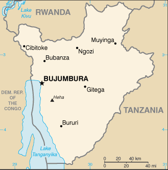
Administrative divisions (GPS Maps)
Geography
People and Society
Government
Economy
Communications
Transportation
Military |
 |
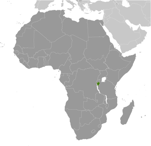
 Burundi's first democratically elected president was assassinated in October 1993 after only 100 days in office, triggering widespread ethnic violence between Hutu and Tutsi factions. More than 200,000 Burundians perished during the conflict that spanned almost a dozen years. Hundreds of thousands of Burundians were internally displaced or became refugees in neighboring countries. An internationally brokered power-sharing agreement between the Tutsi-dominated government and the Hutu rebels in 2003 paved the way for a transition process that led to an integrated defense force, established a new constitution in 2005, and elected a majority Hutu government in 2005. The government of President Pierre NKURUNZIZA, who was reelected in 2010, continues to face many political and economic challenges. Burundi's first democratically elected president was assassinated in October 1993 after only 100 days in office, triggering widespread ethnic violence between Hutu and Tutsi factions. More than 200,000 Burundians perished during the conflict that spanned almost a dozen years. Hundreds of thousands of Burundians were internally displaced or became refugees in neighboring countries. An internationally brokered power-sharing agreement between the Tutsi-dominated government and the Hutu rebels in 2003 paved the way for a transition process that led to an integrated defense force, established a new constitution in 2005, and elected a majority Hutu government in 2005. The government of President Pierre NKURUNZIZA, who was reelected in 2010, continues to face many political and economic challenges. |
|
Advertisements
|
Advertisements
|
Administrative divisions (11,522 GPS Maps)
--- There are no comments yet ---
Add a new comment:
|
Advertisement
Members area
Burundi (Bujumbura):
GPS points from Burundi (Bujumbura)
|