English   Română   Español   Français   Deutsch  

getamap.net

Africa

Oceania

Asia

North America

Europe

South America

Antarctica


2°53'31" S
29°13'19" E
~1,298m asl
21:59 (CAT - UTC/GMT+2)

Gahabwa (Gahabwa) is a populated place (class P - Populated Place) in iProvense ya Cibitoke (Cibitoke), Burundi (Africa) with the region font code of Africa/Middle East. It is located at an elevation of 1,298 meters above sea level.

Its coordinates are 2°53'31" S and 29°13'19" E in DMS (Degrees Minutes Seconds) or -2.89194 and 29.2219 (in decimal degrees). Its UTM position is QS48 and its Joint Operation Graphics reference is SA35-12.

Current local time is 21:59; the sun rises at 08:54 and sets at 21:01 local time (Africa/Bujumbura UTC/GMT+2). The standard time zone for Gahabwa is UTC/GMT+2
In 2024 DST starts on - and ends on -.

A Populated place is a city, town, village, or other agglomeration of buildings where people live and work.


Country
 Advertisements:


 Advertisements:


Weather Gahabwa (Cloud cover, Temperature, Wind speed and Precipitation mm probab.)

Thu


Apr 25
Clound 40-10-60-100 Mist Lightning
~6 l/m2 66%
 
16 °C min
21 °C max
5 km/h
Thu Jan 1

Fri


Apr 26
Clound 40-30-80-90 Lightning
~23 l/m2 97%
 
15 °C min
21 °C max
5 km/h
Thu Jan 1

Sat


Apr 27
Clound 30-40-80-90 Mist Lightning
~14 l/m2 78%
 
15 °C min
22 °C max
9 km/h
Thu Jan 1

Sun


Apr 28
Clound 30-30-70-70 Mist Lightning
~15 l/m2 79%
 
14 °C min
23 °C max
9 km/h
Thu Jan 1

Mon


Apr 29
Clound 30-20-50-80 Mist Lightning
~18 l/m2 80%
 
15 °C min
23 °C max
9 km/h
Thu Jan 1

Tue


Apr 30
Clound 30-10-50-50 Lightning
~27 l/m2 73%
 
15 °C min
23 °C max
7 km/h
Thu Jan 1

Weather Graph

Gahabwa (iProvense ya Cibitoke) 7 day forecast
 

Map and Photos Gahabwa


Comments

--- There are no comments yet ---


Add a new comment:


You have to log in to add a comment!


Members area


Register

Forgot password?

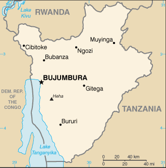
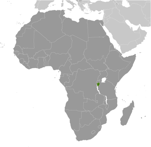
Burundi (Bujumbura):

Advertisement


GPS points near Gahabwa

square Rwesero (0.5km)

square Mirombero (1 km)

square Murwi (2 km)

square Murwi (2 km)

square Murwi (2 km)

square Kibande (2 km)

square Runyami (2 km)


square Murwi (2 km)

square Rubura (2 km)

square Nyamuhinba (2 km)

square Nyamarenge (2 km)

square Bambu (2 km)

square Mugimbu (3 km)


square Nyarusange (3 km)


GPS points from Burundi (Bujumbura)

square Kaguruka Iprovense Ya Kirundo

square Rurembera Iprovense Ya Gitega

square Mwibuya Iprovense Ya Cankuzo

square Nyanzac-lac Iprovense Ya Makamba

square Nkuba Gitega

square Nyantuku Iprovense Ya Makamba

square Munyinya Ruyigi

square Mutaho Iprovense Ya Gitega


viewweather.com sv.ViewWeather.com
fr.ViewWeather.com
da.ViewWeather.com
de.ViewWeather.com
es.ViewWeather.com
www.carpati.org
www.searchromania.net
Deblocari usi
es.getamap.org
fr.getamap.org
de.getamap.org
nl.getamap.org
da.getamap.org
www.getamap.org
Links
Terms of use
Privacy policy

# 0.0653 sec 

contact AT getamap.net

© 2006 - 2024  https://www.getamap.net/