English   Română   Español   Français   Deutsch  

getamap.net

Africa

Oceania

Asia

North America

Europe

South America

Antarctica


Kandos

(Phumi Kandaos) / Khett Kandal

11°28'0" N
104°42'0" E
~24m asl
13:26 (ICT - UTC/GMT+7)

Kandos (Kandos) is a populated place (class P - Populated Place) in Khett Kandal (Cambodia (general)), Cambodia (Asia) with the region font code of Asia/Pacific. It is located at an elevation of 24 meters above sea level.
Kandos is also known as Kandos, Phumi Kandaos, Phumĭ Kândaôs.

Its coordinates are 11°28'0" N and 104°42'0" E in DMS (Degrees Minutes Seconds) or 11.4667 and 104.7 (in decimal degrees). Its UTM position is VT66 and its Joint Operation Graphics reference is NC48-02.

Current local time is 13:26; the sun rises at 08:55 and sets at 21:02 local time (Asia/Phnom_Penh UTC/GMT+7). The standard time zone for Kandos is UTC/GMT+7
In 2024 DST starts on - and ends on -.

A Populated place is a city, town, village, or other agglomeration of buildings where people live and work.


Country
 Advertisements:


 Advertisements:


Weather Kandos (Cloud cover, Temperature, Wind speed and Precipitation mm probab.)

Fri


Apr 19
Clound 0-10-0-20
 
26 °C min
41 °C max
22 km/h
Thu Jan 1

Sat


Apr 20
Clound 0-10-0-40
 
26 °C min
40 °C max
25 km/h
Thu Jan 1

Sun


Apr 21
Clound 0-10-0-90
 
26 °C min
39 °C max
25 km/h
Thu Jan 1

Mon


Apr 22
Clound 0-10-10-90
 
25 °C min
41 °C max
23 km/h
Thu Jan 1

Tue


Apr 23
Clound 0-20-0-90 Lightning
 
26 °C min
40 °C max
30 km/h
Thu Jan 1

Wed


Apr 24
Clound 10-20-10-100 Lightning
~0.3 l/m2 15%
 
27 °C min
39 °C max
28 km/h
Thu Jan 1

Weather Graph

Phumi Kandaos (Khett Kandal) 7 day forecast
 

Map and Photos Kandos


Comments

--- There are no comments yet ---


Add a new comment:


You have to log in to add a comment!


Members area


Register

Forgot password?

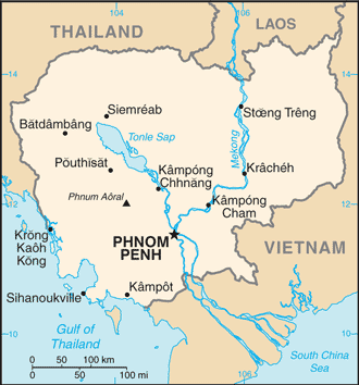
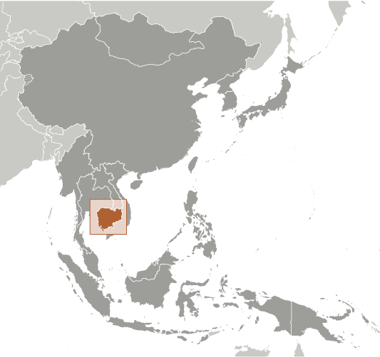
Cambodia (Phnom Penh):

Advertisement


GPS points near Kandos

square Khum Lumhach (1 km)


square Lomhaeh (1 km)


square Phumi Trea (1 km)

square Sar Romeang (1 km)

square Tonleap (1 km)

square Trea (1 km)

square Krang Leav (1 km)


square Phumi Pramor (1 km)

square Pramor (1 km)

square Choeu Teal (1 km)

square Phiri (1 km)


GPS points from Cambodia (Phnom Penh)

square Stoeng Sdau Preah Vihear

square Stung Chrio Khett Kampong Chhnang

square Voeune Sai (cb15)

square Phumi Andong Chrey Kampong Chhnang

square Tak Mak (cb15)

square Vat Tuk Laak Krong Phnum Penh

square Beng Kampong Thum

square Veal Trea (cb01)


viewweather.com sv.ViewWeather.com
fr.ViewWeather.com
da.ViewWeather.com
de.ViewWeather.com
es.ViewWeather.com
www.carpati.org
www.searchromania.net
Deblocari usi
es.getamap.org
fr.getamap.org
de.getamap.org
nl.getamap.org
da.getamap.org
www.getamap.org
Links
Terms of use
Privacy policy

# 0.0682 sec 

contact AT getamap.net

© 2006 - 2024  https://www.getamap.net/