English   Română   Español   Français   Deutsch  

getamap.net

Africa

Oceania

Asia

North America

Europe

South America

Antarctica


Sandy Point

/ Cayman Islands (general)

19°42'0" N
79°58'0" W
~0m asl
05:36 (EST - UTC/GMT--5)

Sandy Point (Sandy Point) is a point (class T - Hypsographic) in Cayman Islands (general), Cayman Islands [ United Kingdom ] (North America) with the region font code of Americas/Western Europe...
Sandy Point is also known as Sand Cliff Point, Sandy Point.

Its coordinates are 19°42'0" N and 79°58'0" W in DMS (Degrees Minutes Seconds) or 19.7 and -79.9667 (in decimal degrees). Its UTM position is PB07 and its Joint Operation Graphics reference is NE17-03.

Current local time is 05:36; the sun rises at 08:55 and sets at 21:02 local time (America/Cayman UTC/GMT-5). The standard time zone for Sandy Point is UTC/GMT-5
In 2024 DST starts on - and ends on -.

A Point is a tapering piece of land projecting into a body of water, less prominent than a cape.


Country
 Advertisements:


 Advertisements:


Weather Sandy Point (Cloud cover, Temperature, Wind speed and Precipitation mm probab.)

Sat


Apr 20
Clound 10-10-0-0
 
26 °C min
27 °C max
31 km/h
Thu Jan 1

Sun


Apr 21
Clound 0-0-0-0
 
26 °C min
28 °C max
25 km/h
Thu Jan 1

Mon


Apr 22
Clound 0-0-0-0
 
26 °C min
27 °C max
15 km/h
Thu Jan 1

Tue


Apr 23
Clound 0-0-0-10
 
26 °C min
28 °C max
15 km/h
Thu Jan 1

Wed


Apr 24
Clound 0-10-0-20
 
26 °C min
28 °C max
25 km/h
Thu Jan 1

Thu


Apr 25
Clound 0-10-0-10
 
26 °C min
28 °C max
30 km/h
Thu Jan 1

Weather Graph

Sandy Point (Cayman Islands (general)) 7 day forecast
 

Map and Photos Sandy Point


Comments

--- There are no comments yet ---


Add a new comment:


You have to log in to add a comment!


Members area


Register

Forgot password?

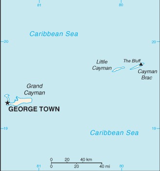
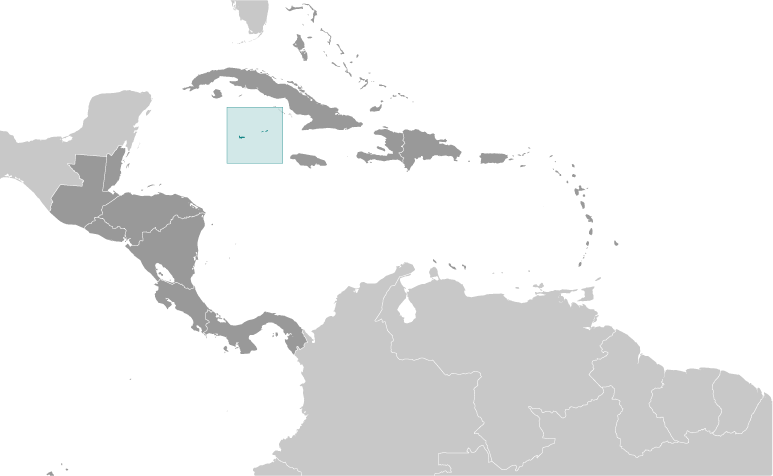
Cayman Islands [ United Kingdom ] (Overseas Territory):

Advertisement


GPS points near Sandy Point

square Weary Hill (1 km)

square The Narrows (1 km)

square Rosetta Flats (1 km)

square Snipe Point (2 km)

square Fish Channel (3 km)

square Marys Bay (3 km)


square North Reef (3 km)

square Big Channel (5 km)

square Crawl Bay (5 km)


square Charles Bay (5 km)

square Charles Bight (5 km)


square Cork Landing (7 km)

square Tarpon Lake (7 km)


GPS points from Cayman Islands [ United Kingdom ] (Overseas Territory)

square Colliers Bay Cayman Islands (general)

square Jackson's Point Cayman Islands (general)

square Salt Creek Cayman Islands (general)

square Sanders Rock Cayman Islands (general)

square Charles Bight Cayman Islands (general)

square Stake Bay Cayman Islands (general)

square High Rock Point Cayman Islands (general)

square Cottage Point Cayman Islands (general)


viewweather.com sv.ViewWeather.com
fr.ViewWeather.com
da.ViewWeather.com
de.ViewWeather.com
es.ViewWeather.com
www.carpati.org
www.searchromania.net
Deblocari usi
es.getamap.org
fr.getamap.org
de.getamap.org
nl.getamap.org
da.getamap.org
www.getamap.org
Links
Terms of use
Privacy policy

# 0.0605 sec 

contact AT getamap.net

© 2006 - 2024  https://www.getamap.net/