|
|
|
An-ying-ts'un
Weather An-ying-ts'un (Cloud cover, Temperature, Wind speed and Precipitation mm probab.)
Map and Photos An-ying-ts'un
Comments
Add a new comment: |
Members area
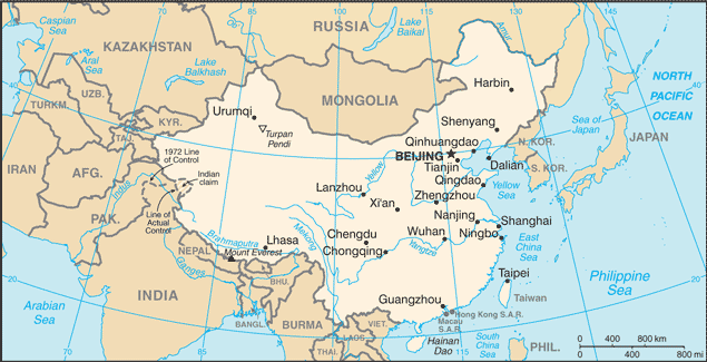
China (Beijing):
Advertisement
GPS points near An-ying-ts'un
 An-jung (0.5km)
Anrong (0.5km)
An-ying-ts'un (0.5km)
Shaling (3 km)
Ta-sha-ling (3 km)
Daiyue Zhan (5 km)
Daiyue (5 km)
Dayyuechzhen (5 km)
Shanyin (5 km)
Shan-yin-hsien (5 km)
Tai-yo (5 km)
Taiyoh (5 km)
Tai-yueh (5 km)
Tai-yueh-chen (5 km)
Shan-yin Hsien (5 km)
Shanyin Xian (5 km)
Luling (5 km)
An-jung (0.5km)
Anrong (0.5km)
An-ying-ts'un (0.5km)
Shaling (3 km)
Ta-sha-ling (3 km)
Daiyue Zhan (5 km)
Daiyue (5 km)
Dayyuechzhen (5 km)
Shanyin (5 km)
Shan-yin-hsien (5 km)
Tai-yo (5 km)
Taiyoh (5 km)
Tai-yueh (5 km)
Tai-yueh-chen (5 km)
Shan-yin Hsien (5 km)
Shanyin Xian (5 km)
Luling (5 km)
GPS points from China (Beijing)
|