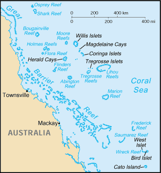
Brodie Cay
19°17'14" S
152°12'50" E
( - UTC/GMT+)
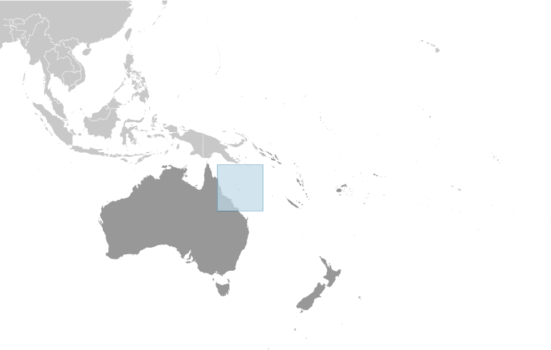
Brodie Cay (Brodie Cay) is a island (class T - Hypsographic) in (Coral Sea Islands (general)), Coral Sea Islands [ Australia ] (Oceania) with the region font code of Americas/Western Europe.
Its coordinates are 19°17'14" S and 152°12'50" E in DMS (Degrees Minutes Seconds) or -19.2872 and 152.214 (in decimal degrees). Its UTM position is MD16 and its Joint Operation Graphics reference is SE56-14.
Current local time is ; the sun rises at 08:55 and sets at 21:02 local time ( UTC/GMT+). The standard time zone for Brodie Cay is UTC/GMT+
In 2024 DST starts on - and ends on -.
A Island is a tract of land, smaller than a continent, surrounded by water at high water.
|
Advertisements:
Advertisements:
|
Weather Brodie Cay (Cloud cover, Temperature, Wind speed and Precipitation mm probab.)
Fri
Apr 19
25 °C min
27 °C max
33 km/h
Thu Jan 1
|
Sat
Apr 20
~0.3 l/m2 35%
25 °C min
27 °C max
30 km/h
Thu Jan 1
|
Sun
Apr 21
~2 l/m2 38%
25 °C min
27 °C max
35 km/h
Thu Jan 1
|
Mon
Apr 22
~5 l/m2 31%
25 °C min
26 °C max
42 km/h
Thu Jan 1
|
Tue
Apr 23
~4 l/m2 31%
25 °C min
26 °C max
40 km/h
Thu Jan 1
|
Wed
Apr 24
~1 l/m2 27%
24 °C min
26 °C max
37 km/h
Thu Jan 1
|
|
|
Map and Photos Brodie Cay
--- There are no comments yet ---
Add a new comment:
|
Members area
Coral Sea Islands [ Australia ]:
Advertisement
GPS points near Brodie Cay
GPS points from Coral Sea Islands [ Australia ]
|