English   Română   Español   Français   Deutsch  

getamap.net

Africa

Oceania

Asia

North America

Europe

South America

Antarctica


Skælingsnes

(Storareyn) / Streymoy

62°6'0" N
7°0'0" W
~164m asl
22:11 (WEST - UTC/GMT+1)

Skaelingsnes (Skælingsnes) is a point (class T - Hypsographic) in Streymoy (Faroe Islands (general)), Faroe Islands [ Denmark ] (Europe) with the region font code of Americas/Western Europe. It is located at an elevation of 164 meters above sea level.

Its coordinates are 62°6'0" N and 7°0'0" W in DMS (Degrees Minutes Seconds) or 62.1 and -7 (in decimal degrees). Its UTM position is PJ08 and its Joint Operation Graphics reference is NP29-06.

Current local time is 22:11; the sun rises at 07:54 and sets at 20:01 local time (Atlantic/Faeroe UTC/GMT+1). The standard time zone for Skaelingsnes is UTC/GMT+0, but since Daylight Saving Time (DST) is in effect the current time zone is UTC/GMT+1.
In 2024 DST starts on 31 Mar 2024 and ends on 27 Oct 2024.

A Point is a tapering piece of land projecting into a body of water, less prominent than a cape.


Country
 Advertisements:


 Advertisements:


Weather Skælingsnes (Cloud cover, Temperature, Wind speed and Precipitation mm probab.)

Tue


Apr 23
Clound 0-0-10-20
 
5 °C min
8 °C max
16 km/h
Thu Jan 1

Wed


Apr 24
Clound 0-10-10-20
 
1 °C min
8 °C max
21 km/h
Thu Jan 1

Thu


Apr 25
Clound 20-90-30-0 Mist
~0.4 l/m2 49%
 
1 °C min
5 °C max
26 km/h
Thu Jan 1

Fri


Apr 26
Clound 40-100-90-10 Mist
~5 l/m2 58%
 
3 °C min
5 °C max
22 km/h
Thu Jan 1

Sat


Apr 27
Clound 30-90-90-0 Mist
~3 l/m2 54%
 
3 °C min
7 °C max
18 km/h
Thu Jan 1

Sun


Apr 28
Clound 40-80-50-20 Mist
~5 l/m2 56%
 
5 °C min
7 °C max
27 km/h
Thu Jan 1

Weather Graph

Storareyn (Streymoy) 7 day forecast
 

Map and Photos Skaelingsnes


Comments

--- There are no comments yet ---


Add a new comment:


You have to log in to add a comment!


Members area


Register

Forgot password?

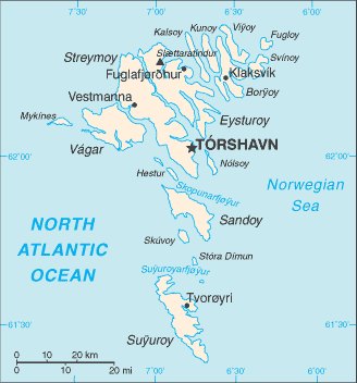
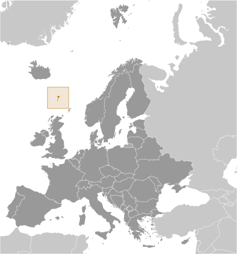
Faroe Islands [ Denmark ] (Denmark):

Advertisement


GPS points near Skælingsnes

square Skaelingsskardh (0.5km)

square Sata (1 km)

square Satan (1 km)

square Gjaarbotnur (2 km)

square Sjothamar (2 km)


square Skaelingur (2 km)


square Trantur (2 km)

square Leinum (2 km)

square Lejnum (2 km)

square Leynar (2 km)

square Leynara (2 km)

square Leynum (2 km)

square Leynum Aa (2 km)

square Stykket (2 km)


GPS points from Faroe Islands [ Denmark ] (Denmark)

square Klaksvig Faroe Islands (general)

square Byttufelli Faroe Islands (general)

square Hammer Faroe Islands (general)

square Leynavatn Streymoy

square Halsur Faroe Islands (general)

square Anirnar Faroe Islands (general)

square Borholidh Streymoy

square Troldenaes Faroe Islands (general)


viewweather.com sv.ViewWeather.com
fr.ViewWeather.com
da.ViewWeather.com
de.ViewWeather.com
es.ViewWeather.com
www.carpati.org
www.searchromania.net
Deblocari usi
es.getamap.org
fr.getamap.org
de.getamap.org
nl.getamap.org
da.getamap.org
www.getamap.org
Links
Terms of use
Privacy policy

# 0.0589 sec 

contact AT getamap.net

© 2006 - 2024  https://www.getamap.net/