English   Română   Español   Français   Deutsch  

getamap.net

Africa

Oceania

Asia

North America

Europe

South America

Antarctica


Snæválsheyggjur

(Valdaskardh) / Suduroy

61°31'60" N
6°51'0" W
~297m asl
14:30 (WEST - UTC/GMT+1)

Snaevalsheyggjur (Snæválsheyggjur) is a hill (class T - Hypsographic) in Suduroy (Faroe Islands (general)), Faroe Islands [ Denmark ] (Europe) with the region font code of Americas/Western Europe. It is located at an elevation of 297 meters above sea level.

Its coordinates are 61°31'60" N and 6°51'0" W in DMS (Degrees Minutes Seconds) or 61.5333 and -6.85 (in decimal degrees). Its UTM position is PJ12 and its Joint Operation Graphics reference is NP29-06.

Current local time is 14:30; the sun rises at 07:55 and sets at 20:02 local time (Atlantic/Faeroe UTC/GMT+1). The standard time zone for Snaevalsheyggjur is UTC/GMT+0, but since Daylight Saving Time (DST) is in effect the current time zone is UTC/GMT+1.
In 2024 DST starts on 31 Mar 2024 and ends on 27 Oct 2024.

A Hill is a rounded elevation of limited extent rising above the surrounding land with local relief of less than 300m.


Country
 Advertisements:


 Advertisements:


Weather Snæválsheyggjur (Cloud cover, Temperature, Wind speed and Precipitation mm probab.)

Fri


Apr 19
Clound 0-60-10-10
 
3 °C min
5 °C max
32 km/h
Thu Jan 1

Sat


Apr 20
Clound 10-90-90-80 Mist
~8 l/m2 71%
 
3 °C min
9 °C max
35 km/h
Thu Jan 1

Sun


Apr 21
Clound 0-50-90-90 Mist
 
8 °C min
9 °C max
31 km/h
Thu Jan 1

Mon


Apr 22
Clound 0-20-30-60 Mist
 
6 °C min
9 °C max
30 km/h
Thu Jan 1

Tue


Apr 23
Clound 0-0-20-30
 
5 °C min
8 °C max
33 km/h
Thu Jan 1

Wed


Apr 24
Clound 0-10-40-60
 
4 °C min
6 °C max
25 km/h
Thu Jan 1

Weather Graph

Valdaskardh (Suduroy) 7 day forecast
 

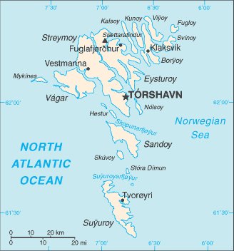
Map and Photos Snaevalsheyggjur


Comments

--- There are no comments yet ---


Add a new comment:


You have to log in to add a comment!


Members area


Register

Forgot password?

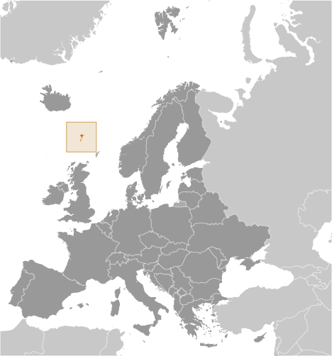
Faroe Islands [ Denmark ] (Denmark):

Advertisement


GPS points near Snæválsheyggjur

square Hvammabotnur (0.5km)

square Kirkjuvatn (0.5km)

square Oraskardh (0.5km)

square Sudero (0.5km)


square Sudhuroy (0.5km)


square Suduroy (0.5km)

square Sydero (0.5km)


square Kirkja (1 km)

square Knukin (1 km)


square Prestgjogv (1 km)

square Ladhanfelli (1 km)

square Famien (2 km)

square Famjin (2 km)


GPS points from Faroe Islands [ Denmark ] (Denmark)

square Hesto Streymoy

square Ritugjov Faroe Islands (general)

square Siglidalur Suduroy

square Mjauvotn Streymoy

square Oreenge Streymoy

square Skalar Faroe Islands (general)

square Mygledal Streymoy

square Aergisa Eysturoy


viewweather.com sv.ViewWeather.com
fr.ViewWeather.com
da.ViewWeather.com
de.ViewWeather.com
es.ViewWeather.com
www.carpati.org
www.searchromania.net
Deblocari usi
es.getamap.org
fr.getamap.org
de.getamap.org
nl.getamap.org
da.getamap.org
www.getamap.org
Links
Terms of use
Privacy policy

# 0.0710 sec 

contact AT getamap.net

© 2006 - 2024  https://www.getamap.net/