English   Română   Español   Français   Deutsch  

getamap.net

Africa

Oceania

Asia

North America

Europe

South America

Antarctica


Kuánit Kangilernga

/ Qaasuitsup

68°4'60" N
52°12'0" W
~11m asl
11:03 (WGST - UTC/GMT--2)

Kuanit Kangilernga (Kuánit Kangilernga) is a bay (class H - Hydrographic) in Qaasuitsup (Vestgrønland), Greenland [ Denmark ] (North America) with the region font code of Americas/Western Europe. It is located at an elevation of 11 meters above sea level.

Its coordinates are 68°4'60" N and 52°12'0" W in DMS (Degrees Minutes Seconds) or 68.0833 and -52.2 (in decimal degrees). Its UTM position is DA55 and its Joint Operation Graphics reference is NR21-12.

Current local time is 11:03; the sun rises at 07:55 and sets at 20:02 local time (America/Godthab UTC/GMT-2). The standard time zone for Kuanit Kangilernga is UTC/GMT-3, but since Daylight Saving Time (DST) is in effect the current time zone is UTC/GMT-2.
In 2024 DST starts on 31 Mar 2024 and ends on 27 Oct 2024.

A Bay is a coastal indentation between two capes or headlands, larger than a cove but smaller than a gulf.


Country
 Advertisements:


 Advertisements:


Weather Kuánit Kangilernga (Cloud cover, Temperature, Wind speed and Precipitation mm probab.)

Thu


Apr 18
Clound 0-20-100-80 Mist
 
-19 °C min
-7 °C max
6 km/h
Thu Jan 1

Fri


Apr 19
Clound 0-30-90-30
 
-16 °C min
-5 °C max
5 km/h
Thu Jan 1

Sat


Apr 20
Clound 0-80-60-0 Mist
~0.3 l/m2 41%
 
-13 °C min
-4 °C max
7 km/h
Thu Jan 1

Sun


Apr 21
Clound 0-80-80-30
 
-14 °C min
2 °C max
14 km/h
Thu Jan 1

Mon


Apr 22
Clound 0-80-80-70 Mist
 
-5 °C min
1 °C max
6 km/h
Thu Jan 1

Tue


Apr 23
Clound 0-70-70-70 Mist
 
-4 °C min
2 °C max
13 km/h
Thu Jan 1

Weather Graph

Kuanit Kangilernga (Qaasuitsup) 7 day forecast
 

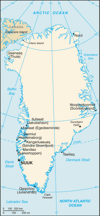
Map and Photos Kuanit Kangilernga


Comments

--- There are no comments yet ---


Add a new comment:


You have to log in to add a comment!


Members area


Register

Forgot password?

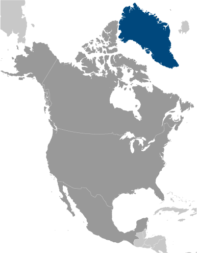
Greenland [ Denmark ] (Denmark):

Advertisement


GPS points near Kuánit Kangilernga

square Ataneq (8 km)


square Akunaq (9 km)

square Akungnak (9 km)

square Arfersiorfik (9 km)


square Kigssaviat (10 km)

square Tarajornitsoq (10 km)

square Sarfanguaq (11 km)

square Sarfannguaq (11 km)


GPS points from Greenland [ Denmark ] (Denmark)

square Portusooq Sermersooq

square Qarssaup Ana Qaasuitsup

square Christians Havn Sermersooq

square Hundeskrant Nordgronland


square Igdloluarsuit Qaasuitsup

square Angit Sermersooq

square Sagdliaruseq Qaasuitsup


viewweather.com sv.ViewWeather.com
fr.ViewWeather.com
da.ViewWeather.com
de.ViewWeather.com
es.ViewWeather.com
www.carpati.org
www.searchromania.net
Deblocari usi
es.getamap.org
fr.getamap.org
de.getamap.org
nl.getamap.org
da.getamap.org
www.getamap.org
Links
Terms of use
Privacy policy

# 0.0600 sec 

contact AT getamap.net

© 2006 - 2024  https://www.getamap.net/