English   Română   Español   Français   Deutsch  

getamap.net

Africa

Oceania

Asia

North America

Europe

South America

Antarctica


Caille Island


12°16'0" N
61°34'0" W
20:45 (AST - UTC/GMT--4)

Caille Island (Caille Island) is a island (class T - Hypsographic) in (Grenada (general)), Grenada (North America) with the region font code of Americas/Western Europe.

Its coordinates are 12°16'0" N and 61°34'0" W in DMS (Degrees Minutes Seconds) or 12.2667 and -61.5667 (in decimal degrees). Its UTM position is PU55 and its Joint Operation Graphics reference is ND20-16.

Current local time is 20:45; the sun rises at 08:55 and sets at 21:02 local time (America/Grenada UTC/GMT-4). The standard time zone for Caille Island is UTC/GMT-4
In 2024 DST starts on - and ends on -.

A Island is a tract of land, smaller than a continent, surrounded by water at high water.


Country
 Advertisements:


 Advertisements:


Weather Caille Island (Cloud cover, Temperature, Wind speed and Precipitation mm probab.)

Fri


Apr 19
Clound 0-10-0-50
~1 l/m2 16%
 
27 °C min
28 °C max
17 km/h
Thu Jan 1

Sat


Apr 20
Clound 20-0-0-60
~8 l/m2 45%
 
27 °C min
28 °C max
23 km/h
Thu Jan 1

Sun


Apr 21
Clound 20-20-30-80 Lightning
~6 l/m2 52%
 
27 °C min
28 °C max
27 km/h
Thu Jan 1

Mon


Apr 22
Clound 20-30-30-40 Lightning
 
27 °C min
29 °C max
32 km/h
Thu Jan 1

Tue


Apr 23
Clound 10-20-10-40
~0.4 l/m2 21%
 
27 °C min
28 °C max
33 km/h
Thu Jan 1

Wed


Apr 24
Clound 10-20-0-50 Lightning
~1 l/m2 14%
 
27 °C min
28 °C max
31 km/h
Thu Jan 1

Weather Graph

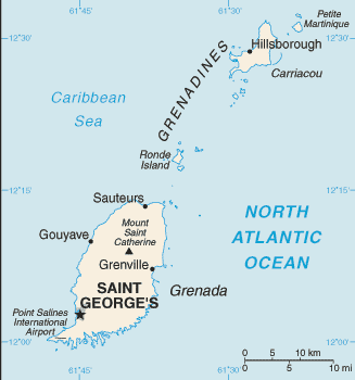
Map and Photos Caille Island


Comments

--- There are no comments yet ---


Add a new comment:


You have to log in to add a comment!


Members area


Register

Forgot password?

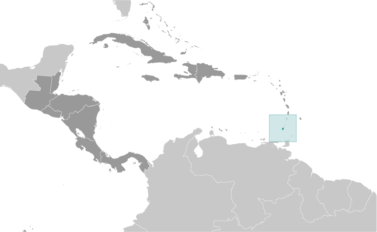
Grenada (Saint George's):

Advertisement


GPS points near Caille Island

square Whale Bay (1 km)

square London Bridge (2 km)


square Redonda (4 km)

square Isle de Ronde (4 km)

square Ronde Island (4 km)

square The Sisters (5 km)

square Les Tantes (5 km)

square Green Island (5 km)

square Green Islet (5 km)

square Sandy Island (5 km)

square Sandy Islet (5 km)

square Bathway Beach (6 km)

square Bedford Point (6 km)

square Grenada Bay (6 km)

square Levera Bay (6 km)

square Levera Island (6 km)


GPS points from Grenada (Saint George's)

square Golflands Saint George


square Pingouin Beach Saint George

square Marigot Bay Saint John

square Saint Johns River Saint George

square Tyrrel Bay Grenada (general)

square Saint James Saint Andrew

square Sandy Island Saint Patrick


viewweather.com sv.ViewWeather.com
fr.ViewWeather.com
da.ViewWeather.com
de.ViewWeather.com
es.ViewWeather.com
www.carpati.org
www.searchromania.net
Deblocari usi
es.getamap.org
fr.getamap.org
de.getamap.org
nl.getamap.org
da.getamap.org
www.getamap.org
Links
Terms of use
Privacy policy

# 0.0601 sec 

contact AT getamap.net

© 2006 - 2024  https://www.getamap.net/