English   Română   Español   Français   Deutsch  

getamap.net

Africa

Oceania

Asia

North America

Europe

South America

Antarctica


Glen Helen

/ Isle of Man

54°13'0" N
4°34'60" W
~264m asl
00:32 (BST - UTC/GMT+1)

Glen Helen (Glen Helen) is a valley (class T - Hypsographic) in Isle of Man (Isle of Man (general)), Isle Of Man [ United Kingdom ] (Europe) with the region font code of Americas/Western Europe. It is located at an elevation of 264 meters above sea level.

Its coordinates are 54°13'0" N and 4°34'60" W in DMS (Degrees Minutes Seconds) or 54.2167 and -4.58333 (in decimal degrees). Its UTM position is UF90 and its Joint Operation Graphics reference is NN30-04.

Current local time is 00:32; the sun rises at 07:55 and sets at 20:02 local time (Europe/Isle_of_Man UTC/GMT+1). The standard time zone for Glen Helen is UTC/GMT+0, but since Daylight Saving Time (DST) is in effect the current time zone is UTC/GMT+1.
In 2024 DST starts on 31 Mar 2024 and ends on 27 Oct 2024.

A Valley is an elongated depression usually traversed by a stream.


Country
 Advertisements:


 Advertisements:


Weather Glen Helen (Cloud cover, Temperature, Wind speed and Precipitation mm probab.)

Fri


Apr 19
Clound 0-10-0-0
8 °C min
10 °C max
36 km/h
Thu Jan 1

Sat


Apr 20
Clound 0-10-40-20
7 °C min
10 °C max
26 km/h
Thu Jan 1

Sun


Apr 21
Clound 0-50-30-30
8 °C min
9 °C max
16 km/h
Thu Jan 1

Mon


Apr 22
Clound 0-40-70-90
8 °C min
11 °C max
41 km/h
Thu Jan 1

Tue


Apr 23
Clound 0-10-20-60
7 °C min
10 °C max
35 km/h
Thu Jan 1

Wed


Apr 24
Clound 10-10-50-10
7 °C min
10 °C max
40 km/h
Thu Jan 1

Weather Graph

Glen Helen (Isle of Man) 7 day forecast
 

Map and Photos Glen Helen


Comments

--- There are no comments yet ---


Add a new comment:


You have to log in to add a comment!


Members area


Register

Forgot password?

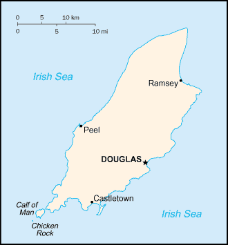
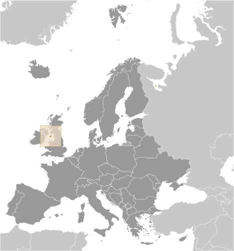
Isle Of Man [ United Kingdom ] (British Crown Dependency):

Advertisement


GPS points near Glen Helen

square Rhenas (2 km)

square Rhenas Fall (2 km)


square Saint Johns (3 km)

square Tynwald Hill (3 km)

square Crosby (3 km)


square Glen Mooar (5 km)

square Foxdale (5 km)

square Isle of Man (6 km)

square Isle of Man (6 km)

square Kirk Braddan (7 km)

square Kirk Braddon (7 km)

square Saint Braddon (7 km)

square Union Mills (7 km)

square Kirkmichael (7 km)


GPS points from Isle Of Man [ United Kingdom ] (British Crown Dependency)

square Sulby Isle Of Man (general)

square Lezayre Isle Of Man

square Andreas Isle Of Man

square Cronky-y-keillown Isle Of Man

square Perwick Bay Isle Of Man

square Saint Maughold Isle Of Man (general)

square Nogging Head Isle Of Man

square River Glass Isle Of Man


viewweather.com sv.ViewWeather.com
fr.ViewWeather.com
da.ViewWeather.com
de.ViewWeather.com
es.ViewWeather.com
www.carpati.org
www.searchromania.net
Deblocari usi
es.getamap.org
fr.getamap.org
de.getamap.org
nl.getamap.org
da.getamap.org
www.getamap.org
Links
Terms of use
Privacy policy

# 0.0628 sec 

contact AT getamap.net

© 2006 - 2024  https://www.getamap.net/