English   Română   Español   Français   Deutsch  

getamap.net

Africa

Oceania

Asia

North America

Europe

South America

Antarctica


Enderlin Horn


47°3'0" N
9°34'0" E
03:11 (CEST - UTC/GMT+2)

Enderlin Horn (Enderlin Horn) is a mountain (class T - Hypsographic) in (Liechtenstein (general)), Liechtenstein (Europe) with the region font code of Americas/Western Europe.

Its coordinates are 47°3'0" N and 9°34'0" E in DMS (Degrees Minutes Seconds) or 47.05 and 9.56667 (in decimal degrees). Its UTM position is NT41 and its Joint Operation Graphics reference is NL32-02.

Current local time is 03:11; the sun rises at 07:55 and sets at 20:02 local time (Europe/Vaduz UTC/GMT+2). The standard time zone for Enderlin Horn is UTC/GMT+1, but since Daylight Saving Time (DST) is in effect the current time zone is UTC/GMT+2.
In 2024 DST starts on 31 Mar 2024 and ends on 27 Oct 2024.

A Mountain is an elevation standing high above the surrounding area with small summit area, steep slopes and local relief of 300m or more.


Country
 Advertisements:


 Advertisements:


Weather Enderlin Horn (Cloud cover, Temperature, Wind speed and Precipitation mm probab.)

Thu


Apr 18
Clound 50-90-10-0 Mist
~3 l/m2 60%
 
2-3 cm (Snow)
-4 °C min
-0 °C max
13 km/h
Thu Jan 1

Fri


Apr 19
Clound 10-80-80-70 Mist
~10 l/m2 97%
 
4-10 cm (Snow)
-6 °C min
1 °C max
8 km/h
Thu Jan 1

Sat


Apr 20
Clound 40-100-100-0 Mist
~47 l/m2 97%
 
27-47 cm (Snow)
-3 °C min
-0 °C max
14 km/h
Thu Jan 1

Sun


Apr 21
Clound 20-100-90-0 Mist
~13 l/m2 86%
 
7-13 cm (Snow)
-6 °C min
-1 °C max
15 km/h
Thu Jan 1

Mon


Apr 22
Clound 10-60-100-30 Mist
~0.4 l/m2 44%
 
-11 °C min
-0 °C max
10 km/h
Thu Jan 1

Tue


Apr 23
Clound 10-50-40-20 Mist
 
-8 °C min
1 °C max
11 km/h
Thu Jan 1

Weather Graph

Map and Photos Enderlin Horn


Comments

--- There are no comments yet ---


Add a new comment:


You have to log in to add a comment!


Members area


Register

Forgot password?

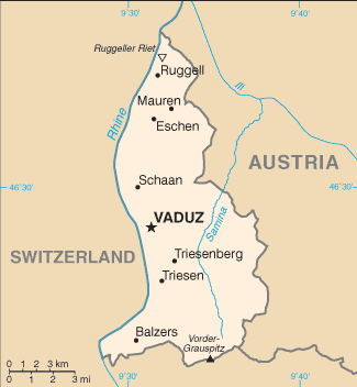
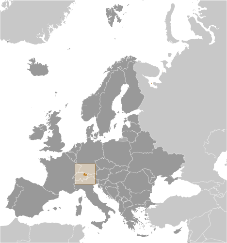
Liechtenstein (Vaduz):

Advertisement


GPS points near Enderlin Horn

square Grauspitz (1 km)

square Grauspitz (1 km)


square Lawena (1 km)

square Naafkopf (2 km)

square Nauf Kopf (2 km)

square Valuna (3 km)

square Bettlerjoch (4 km)

square Mals (5 km)

square Balzers (5 km)

square Balzers (5 km)


square Triesen (6 km)

square Triesen (6 km)


GPS points from Liechtenstein (Vaduz)

square Gambrin Gemeinde Gamprin

square Ochsenberg Liechtenstein (general)

square Gamprin-bendern Gemeinde Gamprin

square Mauren Gemeinde Mauren

square Lawena Liechtenstein (general)

square Schaanwald Mauren

square Eschen Gemeinde Eschen

square Gemeinde Balzers Gemeinde Balzers


viewweather.com sv.ViewWeather.com
fr.ViewWeather.com
da.ViewWeather.com
de.ViewWeather.com
es.ViewWeather.com
www.carpati.org
www.searchromania.net
Deblocari usi
es.getamap.org
fr.getamap.org
de.getamap.org
nl.getamap.org
da.getamap.org
www.getamap.org
Links
Terms of use
Privacy policy

# 0.0676 sec 

contact AT getamap.net

© 2006 - 2024  https://www.getamap.net/