49°52'1" N
5°46'24" E
~370m asl
05:52 (CEST - UTC/GMT+2)
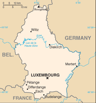
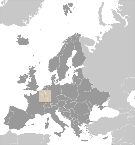
Rommelerhaff (Rommelerhaff) is a populated locality (class P - Populated Place) in District de Diekirch (Diekirch), Luxembourg (Europe) with the region font code of Americas/Western Europe. It is located at an elevation of 370 meters above sea level.
Rommelerhaff is also known as Ferme Martelinville, Martelinville, Rommeldange, Rommelerhaff, Rommelerhof.
Its coordinates are 49°52'1" N and 5°46'24" E in DMS (Degrees Minutes Seconds) or 49.8669 and 5.77333 (in decimal degrees). Its UTM position is FR92 and its Joint Operation Graphics reference is NM31-09.
Current local time is 05:52; the sun rises at 07:54 and sets at 20:01 local time (Europe/Luxembourg UTC/GMT+2). The standard time zone for Rommelerhaff is UTC/GMT+1, but since Daylight Saving Time (DST) is in effect the current time zone is UTC/GMT+2.
In 2024 DST starts on 31 Mar 2024 and ends on 27 Oct 2024.
A Populated locality is an area similar to a locality but with a small group of dwellings or other buildings.
|
Advertisements:
Advertisements:
|
Weather Rommelerhaff (Cloud cover, Temperature, Wind speed and Precipitation mm probab.)
Wed
Apr 24
~2 l/m2 47%
3 °C min
7 °C max
25 km/h
Thu Jan 1
|
Thu
Apr 25
~1 l/m2 55%
-2 °C min
7 °C max
17 km/h
Thu Jan 1
|
Fri
Apr 26
~1 l/m2 54%
0 °C min
11 °C max
17 km/h
Thu Jan 1
|
Sat
Apr 27
~3 l/m2 66%
5 °C min
13 °C max
26 km/h
Thu Jan 1
|
Sun
Apr 28
~5 l/m2 65%
9 °C min
13 °C max
32 km/h
Thu Jan 1
|
Mon
Apr 29
~0.4 l/m2 44%
7 °C min
14 °C max
18 km/h
Thu Jan 1
|
|
|
Martelinville (District de Diekirch) 7 day forecast
Map and Photos Rommelerhaff
--- There are no comments yet ---
Add a new comment:
|
Members area
Luxembourg (Luxembourg City):
Advertisement
GPS points near Rommelerhaff
GPS points from Luxembourg (Luxembourg City)
 Klerf District De Diekirch
Lellig District De Grevenmacher
|