|

Administrative divisions (GPS Maps)
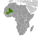
Geography
People and Society
Government
Economy
Communications
Transportation
Military |
 |
 The Sudanese Republic and Senegal became independent of France in 1960 as the Mali Federation. When Senegal withdrew after only a few months, what formerly made up the Sudanese Republic was renamed Mali. Rule by dictatorship was brought to a close in 1991 by a military coup that ushered in a period of democratic rule. President Alpha KONARE won Mali's first two democratic presidential elections in 1992 and 1997. In keeping with Mali's two-term constitutional limit, he stepped down in 2002 and was succeeded by Amadou TOURE, who was elected to a second term in 2007 elections that were widely judged to be free and fair. The Sudanese Republic and Senegal became independent of France in 1960 as the Mali Federation. When Senegal withdrew after only a few months, what formerly made up the Sudanese Republic was renamed Mali. Rule by dictatorship was brought to a close in 1991 by a military coup that ushered in a period of democratic rule. President Alpha KONARE won Mali's first two democratic presidential elections in 1992 and 1997. In keeping with Mali's two-term constitutional limit, he stepped down in 2002 and was succeeded by Amadou TOURE, who was elected to a second term in 2007 elections that were widely judged to be free and fair. |
|
Advertisements
|
Advertisements
|
Administrative divisions (20,281 GPS Maps)
--- There are no comments yet ---
Add a new comment:
|
Advertisement
Members area
Mali (Bamako):
GPS points from Mali (Bamako)
|

