English   Română   Español   Français   Deutsch  

getamap.net

Africa

Oceania

Asia

North America

Europe

South America

Antarctica


Mtsanga Chanfi

/ M'Tsangamouji

12°44'56" S
45°3'16" E
~462m asl
02:40 (EAT - UTC/GMT+3)

Mtsanga Chanfi (Mtsanga Chanfi) is a beach (class T - Hypsographic) in M'Tsangamouji (Mayotte (general)), Mayotte [ France ] (Africa) with the region font code of Africa/Middle East. It is located at an elevation of 462 meters above sea level.

Its coordinates are 12°44'56" S and 45°3'16" E in DMS (Degrees Minutes Seconds) or -12.7489 and 45.0544 (in decimal degrees). Its UTM position is NL09 and its Joint Operation Graphics reference is SD38-02.

Current local time is 02:40; the sun rises at 08:54 and sets at 21:01 local time (Indian/Mayotte UTC/GMT+3). The standard time zone for Mtsanga Chanfi is UTC/GMT+3
In 2024 DST starts on - and ends on -.

A Beach is a shore zone of coarse unconsolidated sediment that extends from the low-water line to the highest reach of storm waves.


Country
 Advertisements:


 Advertisements:


Weather Mtsanga Chanfi (Cloud cover, Temperature, Wind speed and Precipitation mm probab.)

Thu


Apr 25
Clound 0-0-0-10
 
29 °C min
30 °C max
26 km/h
Thu Jan 1

Fri


Apr 26
Clound 20-0-0-80
~5 l/m2 32%
 
28 °C min
30 °C max
22 km/h
Thu Jan 1

Sat


Apr 27
Clound 40-10-20-100 Lightning
~25 l/m2 70%
 
27 °C min
29 °C max
27 km/h
Thu Jan 1

Sun


Apr 28
Clound 40-10-10-100 Lightning
~17 l/m2 67%
 
28 °C min
30 °C max
33 km/h
Thu Jan 1

Mon


Apr 29
Clound 30-10-0-70 Lightning
~6 l/m2 49%
 
28 °C min
29 °C max
25 km/h
Thu Jan 1

Tue


Apr 30
Clound 20-10-0-90
~12 l/m2 51%
 
28 °C min
29 °C max
29 km/h
Thu Jan 1

Weather Graph

Mtsanga Chanfi (M'Tsangamouji) 7 day forecast
 

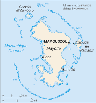
Map and Photos Mtsanga Chanfi


Comments

--- There are no comments yet ---


Add a new comment:


You have to log in to add a comment!


Members area


Register

Forgot password?

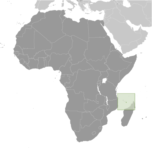
Mayotte [ France ] (Overseas Territory):

Advertisement


GPS points near Mtsanga Chanfi

square Mliha (0.5km)

square Moutsoumbatsou (0.5km)

square Tanaraki (1 km)


square Bandrakouni (1 km)

square Tanambao (1 km)


square Analavato (2 km)

square Baie d' Acoua (2 km)

square Chembenioumba (2 km)

square Chembenyoumba (2 km)

square Accua (2 km)

square Acoua (2 km)

square Mroni Kavani (3 km)


GPS points from Mayotte [ France ] (Overseas Territory)

square Dzoumogne Mayotte (general)

square Majimeouni Mayotte (general)

square Gnambo Mayotte (general)

square Rassi Domonyombe Mayotte (general)

square Rassi Douamounyo Mayotte (general)

square Mro Oua Daradjojou Mayotte (general)

square Accua Acoua

square Bandrele Bandrele


viewweather.com sv.ViewWeather.com
fr.ViewWeather.com
da.ViewWeather.com
de.ViewWeather.com
es.ViewWeather.com
www.carpati.org
www.searchromania.net
Deblocari usi
es.getamap.org
fr.getamap.org
de.getamap.org
nl.getamap.org
da.getamap.org
www.getamap.org
Links
Terms of use
Privacy policy

# 0.0718 sec 

contact AT getamap.net

© 2006 - 2024  https://www.getamap.net/