1°0'0" S
15°0'0" E
~504m asl
21:23 (WAT - UTC/GMT+1)
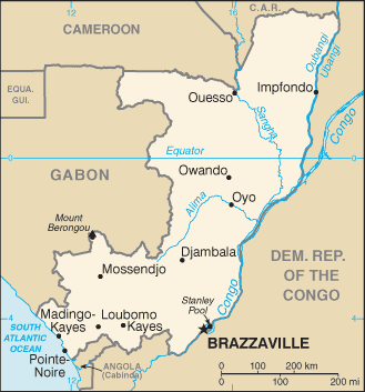
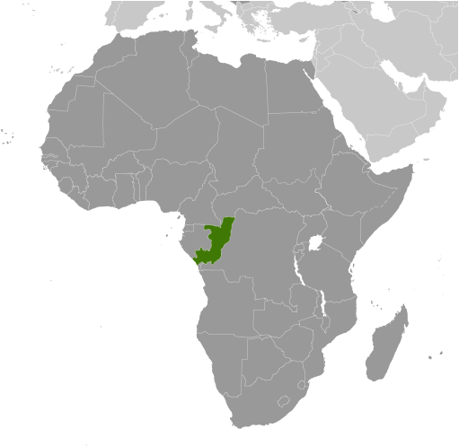
Republique Populaire du Congo (République Populaire du Congo) is a independent political entity (class A - Administrative Region) in Republic of the Congo (general) (Congo (general)), Republic Of The Congo (Africa) with the region font code of Africa/Middle East. It is located at an elevation of 504 meters above sea level and its population amounts to 3,039,126.
République Populaire du Congo is also known as An Congo, An Congó, Concu, Cong hoa Congo, Cong-go, Cong-go (Congo), Congo, Congo (Brazzaville), Congo-Brazzaville, Còngo, Công-gô, Công-gô (Congo), Cộng hoà Congo, Demokratia tou Kon'nko, Jamhuri ya Kongo, Kon'nko, Konga, Kongas, Kongo, Kongo (Brazzaville), Kongo (Republik Kongo), Kongo - Brazzavil', Kongo - Brazzaville, Kongo Brazavila, Kongo Cumhuriyeti, Kongo Respublika, Kongo Vabariik, Kongo – Brazzaville, Kongo-Brazzaville, Kongoaen, Kongoi Koeztarsasag, Kongoko Errepublika, Kongolo, Kongon tasavalta, Kongoän, Kongó, Kongói Köztársaság, Kɔngɔ́ (Brazzaville), Middle Congo, Moyen-Congo, Repoblek Kongo, Repubblica del Congo, Repubilika ya Kongo, Republic of the Congo, Republica Congo, Republica d'o Congo, Republica de Congo, Republica de Còngo, Republica del Congo, Republica del Congò, Republica du Congo, Republiek van die Kongo, Republik Congo, Republik Kongo, Republika Konga, Republika Kongo, Republika e Kongos, Republika ng Congo, Republiken Kongo, Republiki ya Kɔ́ngɔ, Republikken Congo, Republikken Kongo, Republiko Kongo, Republique Populaire du Congo, Republique du Congo, República del Congo, Respublica Congensis, Respublika Kongo, Rèpublica du Congô, République Populaire du Congo, République du Congo, Vestur-Kongo, Vestur-Kongó, alkwnghw, alkwnghw - brazafyl, gang guo, gang guo gong he guo, hrpwblyqh sl qwngw, jmhwry kngw, jmhwryt alkwnghw, kango, kangw, kanko, keangea, khxngko, kong-go, kong-go gonghwagug, kongo, kongo gong he guo, kwngw, qwngw, satharnrath khxngko, Δημοκρατία του Κονγκό, Κονγκό, Конга, Конго, Конґо, Конґо - Браззавіль, Република Конго, Республика Конго, Կոնգո, הרפובליקה של קונגו, קונגו, الكونغو, الكونغو - برازافيل, جمهورية الكونغو, جمهوری کنگو, د کانګو جمهوريت, كونگو, کانگو, کونگو, कांगो, कोंगो, কঙ্গো, காங்கோ, കോംഗോ, คองโก, สาธารณรัฐคองโก, ຄອງໂກ, ཀོང་ཀོ, კონგო, ኮንጎ ሪፑብሊክ, ኮንጐ, កុងហ្គោ, コンゴ, コンゴ共和国, 刚果, 刚果共和国, 콩고, 콩고 공화국.
Its coordinates are 1°0'0" S and 15°0'0" E in DMS (Degrees Minutes Seconds) or -1 and 15 (in decimal degrees). Its UTM position is WU08 and its Joint Operation Graphics reference is SA33-02.
Current local time is 21:23; the sun rises at 08:54 and sets at 21:01 local time (Africa/Brazzaville UTC/GMT+1). The standard time zone for Republique Populaire du Congo is UTC/GMT+1
In 2024 DST starts on - and ends on -.
|
Advertisements:
Advertisements:
|


