English   Română   Español   Français   Deutsch  

getamap.net

Africa

Oceania

Asia

North America

Europe

South America

Antarctica


Étang des Herbiers


46°45'39" N
56°10'55" W
21:20 (PMDT - UTC/GMT--2)

Etang des Herbiers (Étang des Herbiers) is a pond (class H - Hydrographic) in (Saint Pierre and Miquelon (general)), Saint Pierre And Miquelon [ France ] (North America) with the region font code of Americas/Western Europe.

Its coordinates are 46°45'39" N and 56°10'55" W in DMS (Degrees Minutes Seconds) or 46.7608 and -56.1819 (in decimal degrees). Its UTM position is WM67 and its Joint Operation Graphics reference is NL21-02.

Current local time is 21:20; the sun rises at 07:55 and sets at 20:02 local time (America/Miquelon UTC/GMT-2). The standard time zone for Etang des Herbiers is UTC/GMT-3, but since Daylight Saving Time (DST) is in effect the current time zone is UTC/GMT-2.
In 2024 DST starts on 10 Mar 2024 and ends on 3 Nov 2024.

A Pond is a small standing waterbody.


Country
 Advertisements:


 Advertisements:


Weather Étang des Herbiers (Cloud cover, Temperature, Wind speed and Precipitation mm probab.)

Thu


Apr 18
Clound 0-100-80-90 Mist
 
2 °C min
3 °C max
51 km/h
Thu Jan 1

Fri


Apr 19
Clound 0-90-40-50 Mist
~13 l/m2 95%
 
2-4 cm (Snow)
0 °C min
4 °C max
63 km/h
Thu Jan 1

Sat


Apr 20
Clound 0-10-0-40
 
0 °C min
4 °C max
27 km/h
Thu Jan 1

Sun


Apr 21
Clound 0-90-90-80 Mist
~21 l/m2 97%
 
2 °C min
5 °C max
57 km/h
Thu Jan 1

Mon


Apr 22
Clound 0-20-10-10 Mist
 
2 °C min
4 °C max
33 km/h
Thu Jan 1

Tue


Apr 23
Clound 0-40-0-50
 
0 °C min
4 °C max
39 km/h
Thu Jan 1

Weather Graph

Map and Photos Etang des Herbiers


Comments

--- There are no comments yet ---


Add a new comment:


You have to log in to add a comment!


Members area


Register

Forgot password?

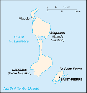
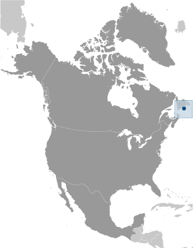
Saint Pierre And Miquelon [ France ] (Overseas Territory):

Advertisement


GPS points near Étang des Herbiers

square Etangs Jumelles (0.5km)

square Etang Jourdan (0.5km)

square La Langue (0.5km)

square Petit Havre (0.5km)

square Saint-Pierre (0.5km)


square Etang Bonnier (0.5km)

square Etang du Milieu (0.5km)


square Pointe Blanche (0.5km)

square Bonnier (1 km)

square Etang Boulot (1 km)

square La Beugresse (1 km)


square Les Flacous (1 km)

square Le Barachois (1 km)

square Le Rond-Point (1 km)


GPS points from Saint Pierre And Miquelon [ France ] (Overseas Territory)

square Cap Aux Basques Saint Pierre And Miquelon (general)

square Ruisseau De L' Ouest Saint Pierre And Miquelon (general)

square Devalee Du Diable Saint Pierre And Miquelon (general)

square Etang Ynachi Saint Pierre And Miquelon (general)

square Le Trepied Saint Pierre And Miquelon (general)

square Grande Basse Saint Pierre And Miquelon (general)

square Grand Etang Des Fourches Saint Pierre And Miquelon (general)

square Les Cailloux De Terre Saint Pierre And Miquelon (general)


viewweather.com sv.ViewWeather.com
fr.ViewWeather.com
da.ViewWeather.com
de.ViewWeather.com
es.ViewWeather.com
www.carpati.org
www.searchromania.net
Deblocari usi
es.getamap.org
fr.getamap.org
de.getamap.org
nl.getamap.org
da.getamap.org
www.getamap.org
Links
Terms of use
Privacy policy

# 0.0611 sec 

contact AT getamap.net

© 2006 - 2024  https://www.getamap.net/