12°58'0" N
61°7'60" W
~0m asl
02:33 (AST - UTC/GMT--4)
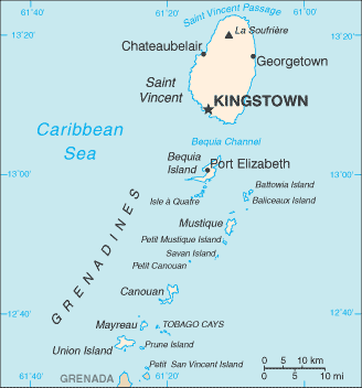
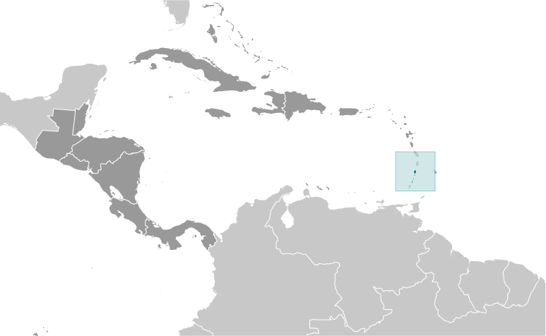
Battowia Island (Battowia Island) is a island (class T - Hypsographic) in Grenadines, Saint Vincent And The Grenadines (North America) with the region font code of Americas/Western Europe...
Battowia Island is also known as Battowia, Battowia Island, Battowia Islet.
Its coordinates are 12°58'0" N and 61°7'60" W in DMS (Degrees Minutes Seconds) or 12.9667 and -61.1333 (in decimal degrees). Its UTM position is QV03 and its Joint Operation Graphics reference is ND20-16.
Current local time is 02:33; the sun rises at 08:56 and sets at 21:03 local time (America/St_Vincent UTC/GMT-4). The standard time zone for Battowia Island is UTC/GMT-4
In 2024 DST starts on - and ends on -.
A Island is a tract of land, smaller than a continent, surrounded by water at high water.
|
Advertisements:
Advertisements:
|
Weather Battowia Island (Cloud cover, Temperature, Wind speed and Precipitation mm probab.)
Mon
Apr 15
~0.4 l/m2 24%
27 °C min
28 °C max
32 km/h
Thu Jan 1
|
Tue
Apr 16
27 °C min
29 °C max
33 km/h
Thu Jan 1
|
Wed
Apr 17
~2 l/m2 25%
27 °C min
29 °C max
31 km/h
Thu Jan 1
|
Thu
Apr 18
~2 l/m2 27%
27 °C min
29 °C max
29 km/h
Thu Jan 1
|
Fri
Apr 19
~2 l/m2 30%
27 °C min
28 °C max
25 km/h
Thu Jan 1
|
Sat
Apr 20
~14 l/m2 56%
27 °C min
29 °C max
25 km/h
Thu Jan 1
|
|
|
Battowia Island (Grenadines) 7 day forecast
Map and Photos Battowia Island
--- There are no comments yet ---
Add a new comment:
|
Members area
Saint Vincent And The Grenadines (Kingstown):
Advertisement
GPS points near Battowia Island
GPS points from Saint Vincent And The Grenadines (Kingstown)
 Point Bay Saint Vincent And The Grenadines (general)
|